Available for Projects

Abraham
Abubaker

Geospatial & LiDAR Systems Engineer · Surveying Specialist

Transforming complex terrain into high-precision, actionable data with advanced LiDAR and UAV technology.

6+
Years Experience
3
Languages
cm
Level Accuracy
Scroll
Services

Professional Engineering Services

In the complex environment of modern infrastructure and construction, precision is the primary safeguard against project delays and structural failure. I provide a comprehensive suite of geospatial and engineering services designed to bring absolute clarity to the site. By integrating advanced geodetic control, high-resolution aerial mapping, and subsurface utility detection, I deliver the high-fidelity data required for informed decision-making, rigorous design compliance, and long-term asset integrity.

Construction surveying on site

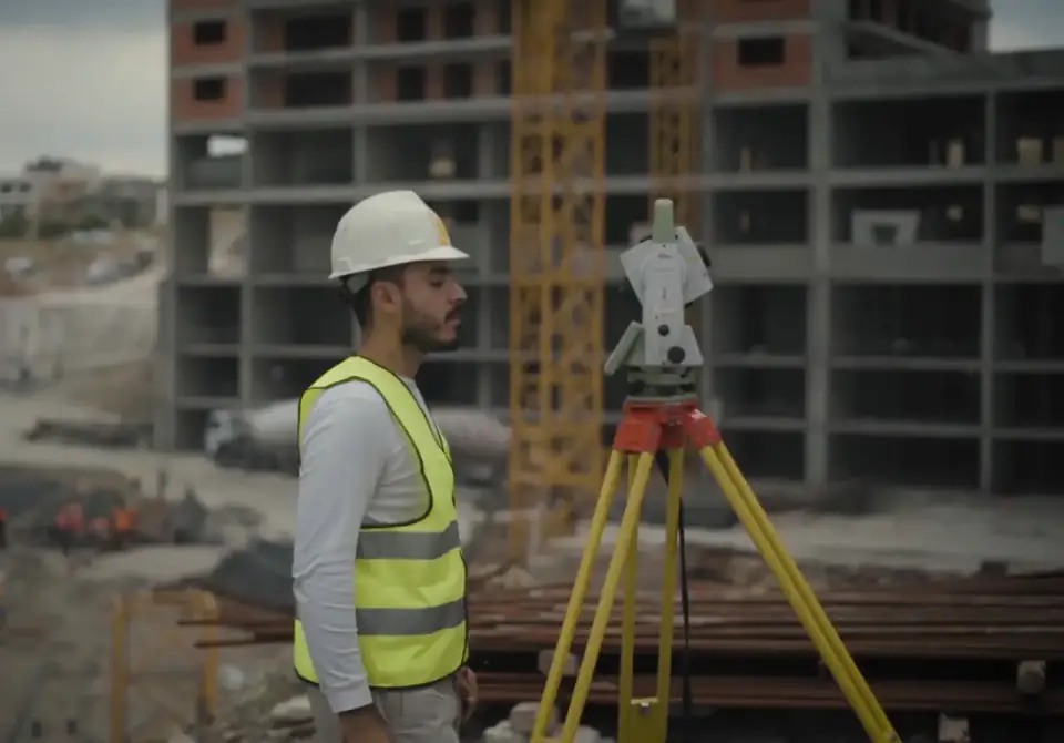
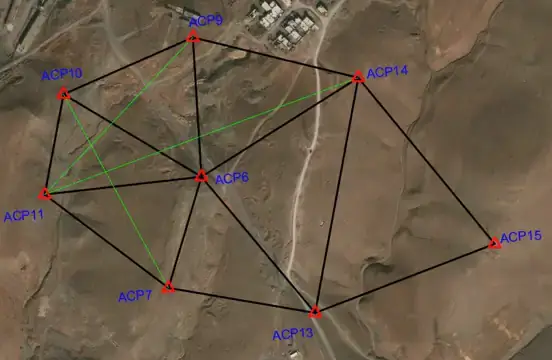
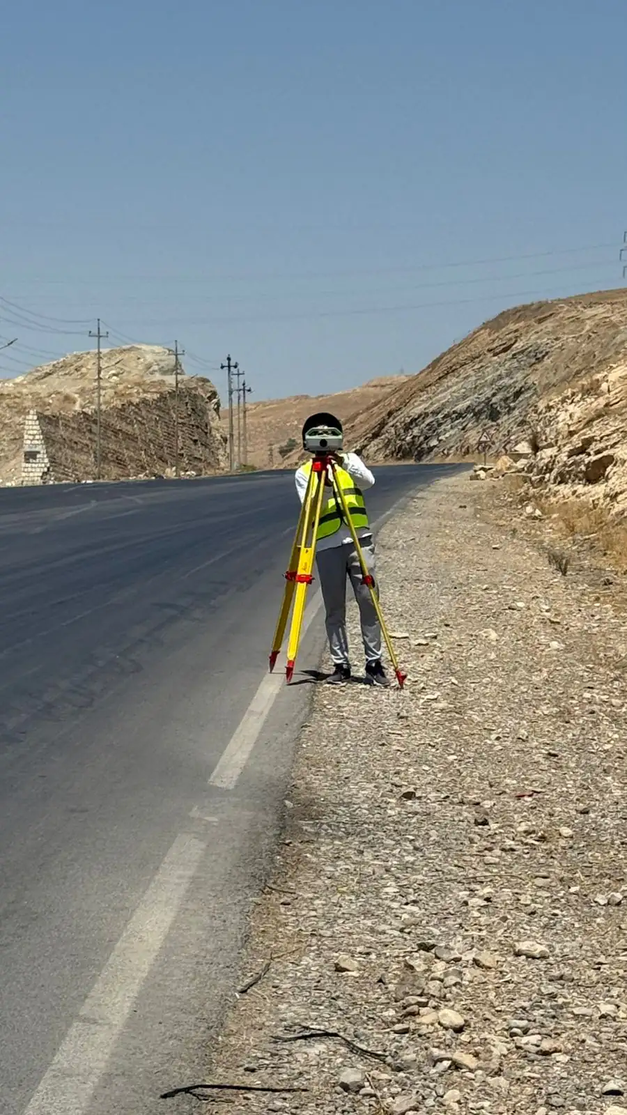
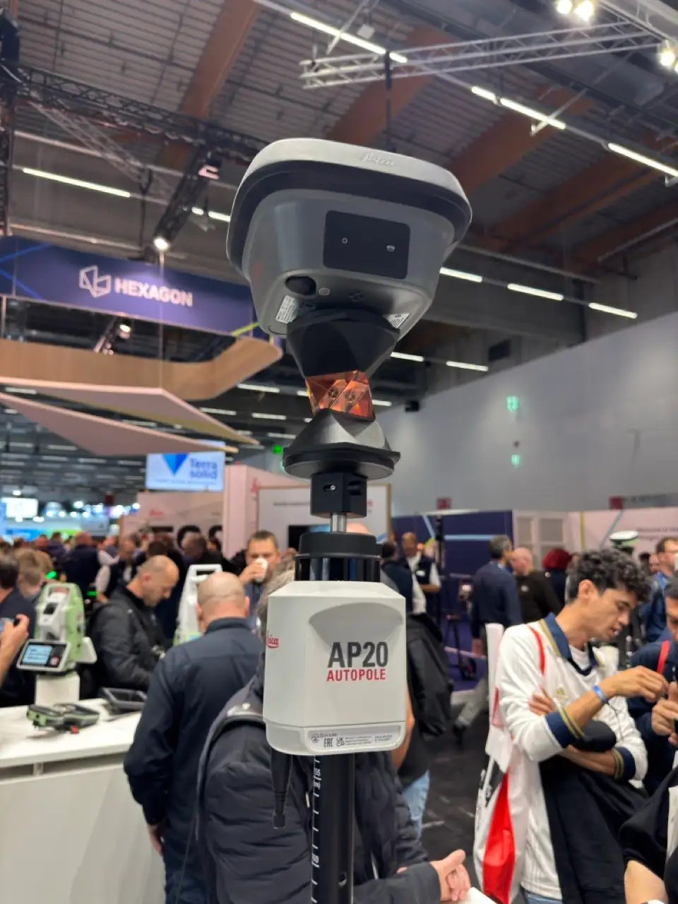
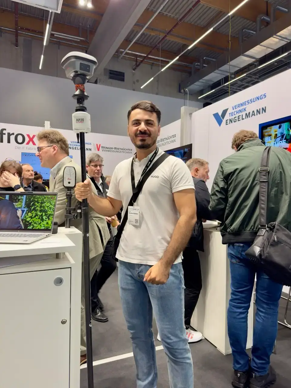
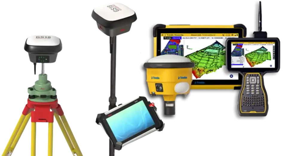
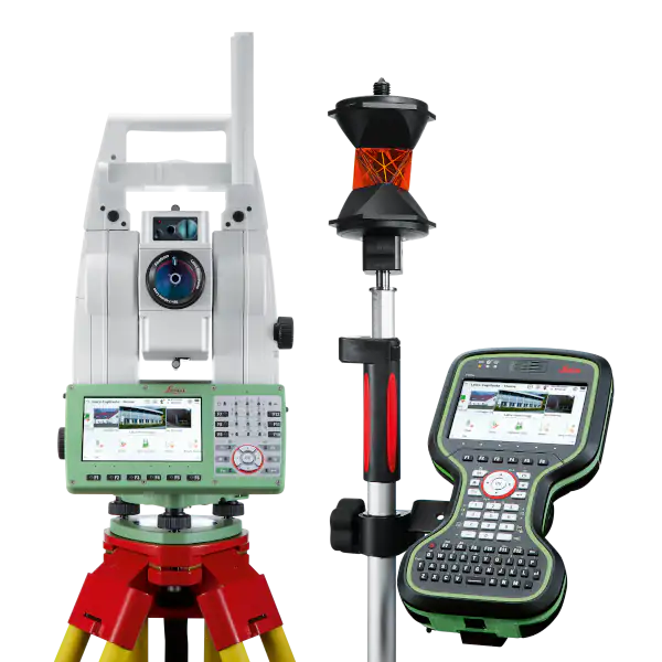
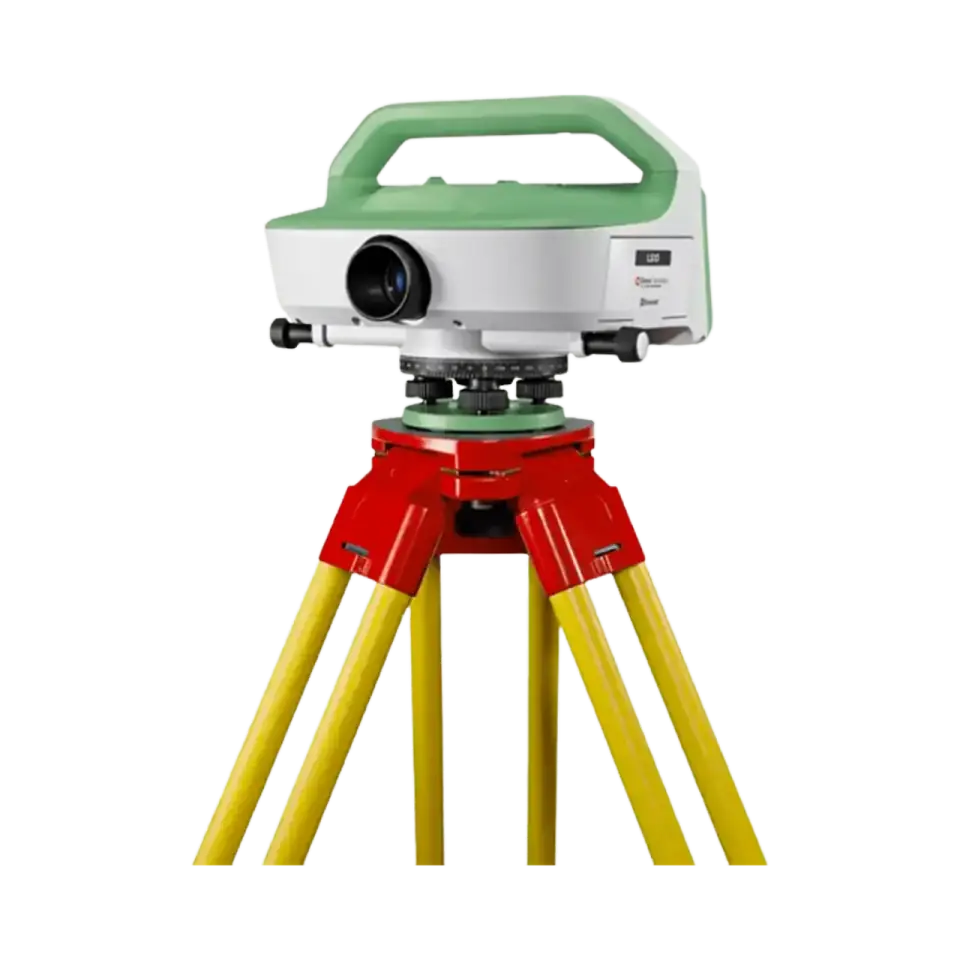
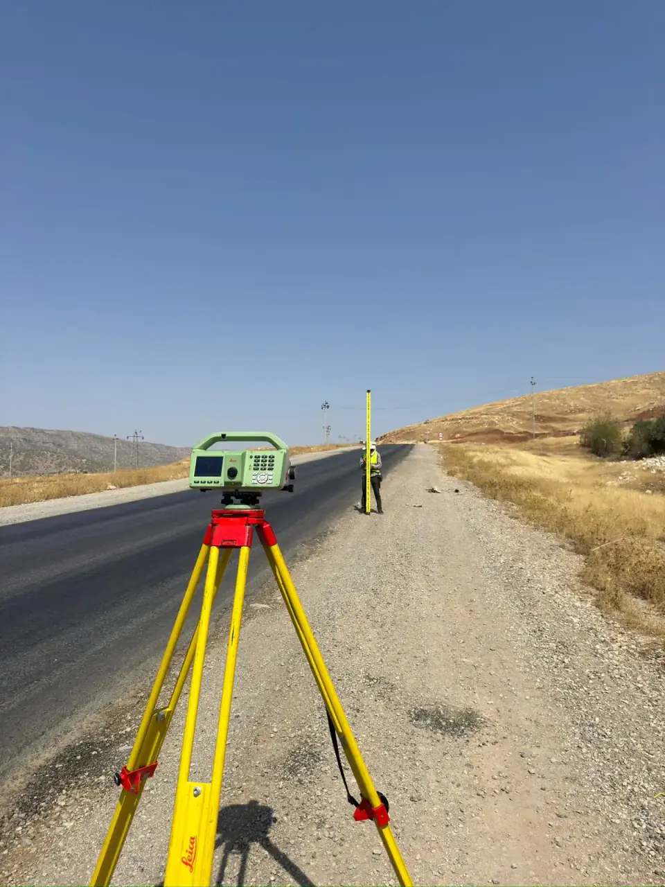
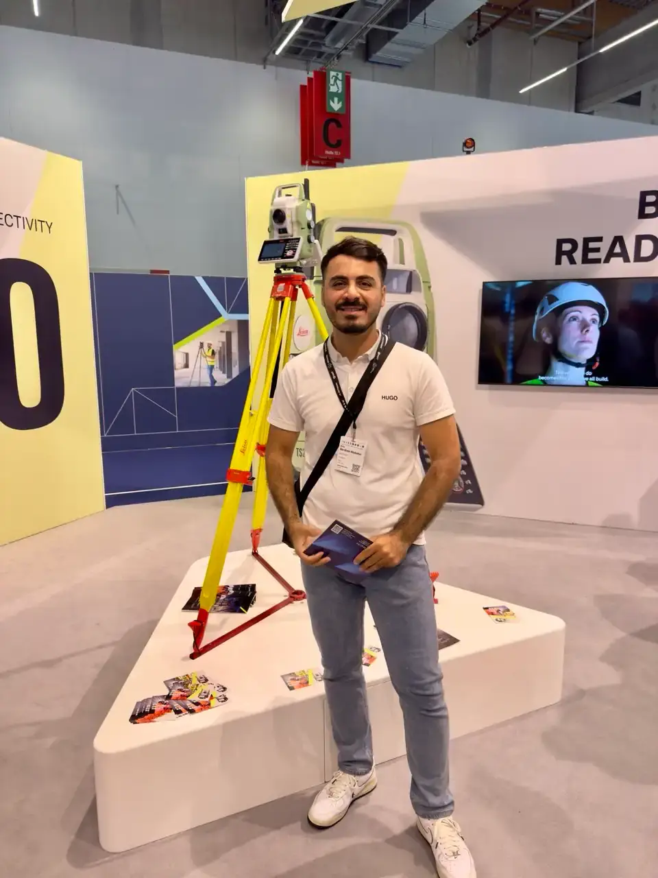
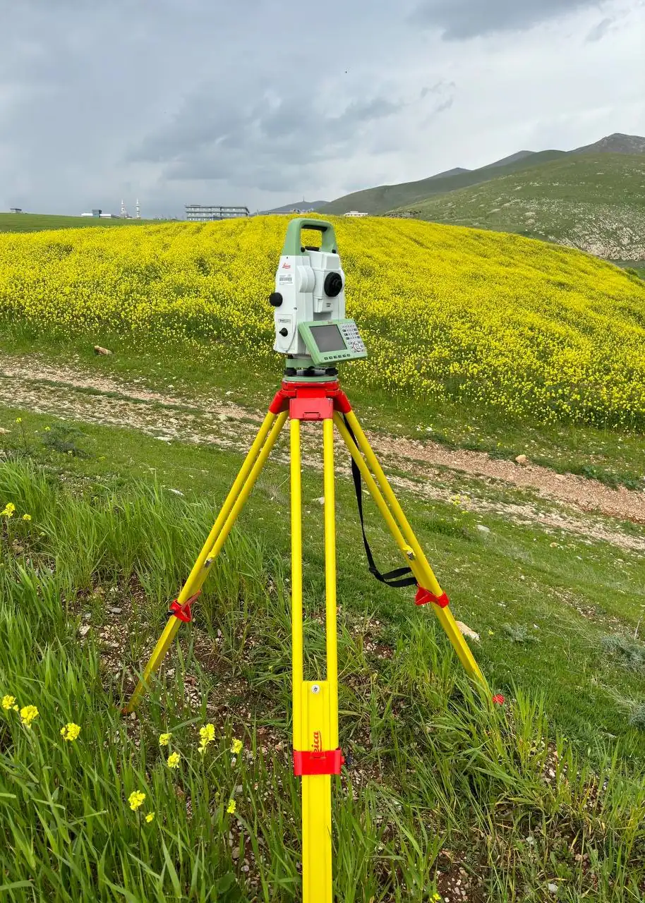
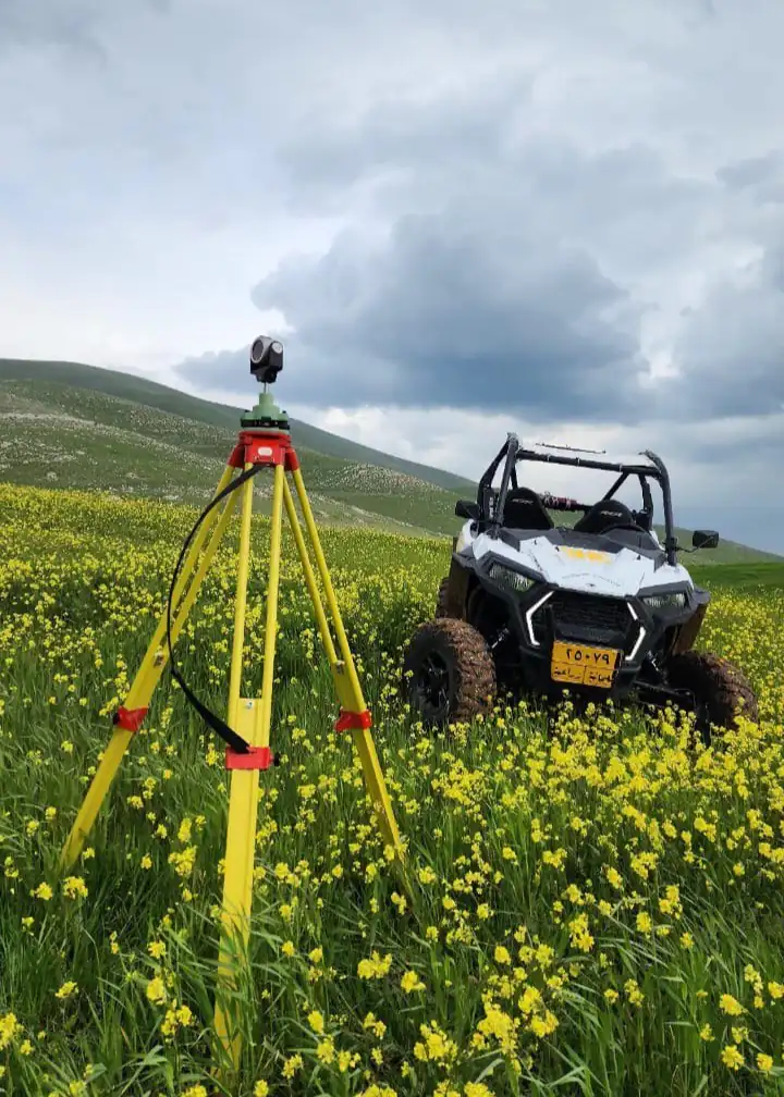
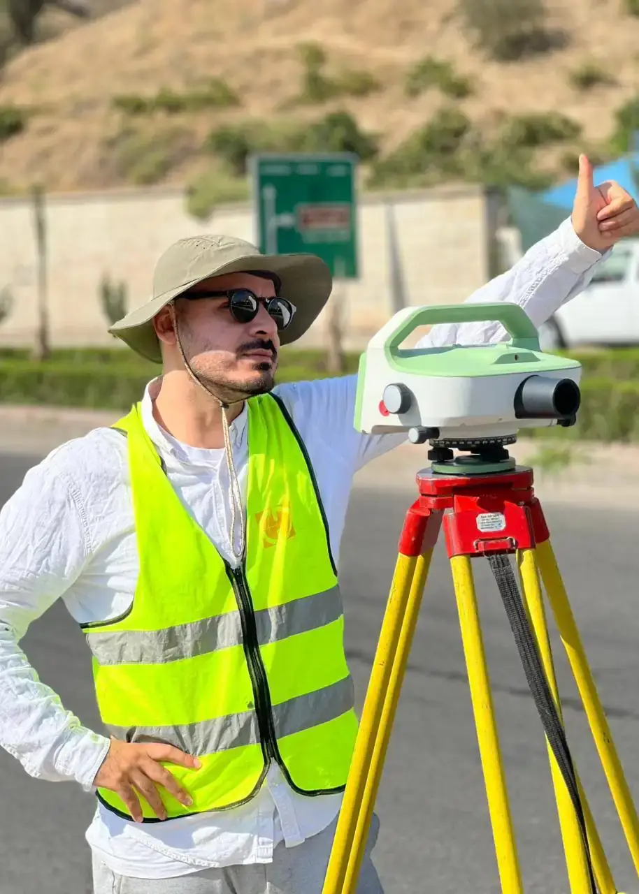
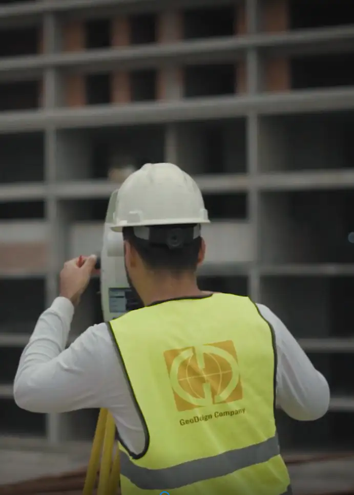
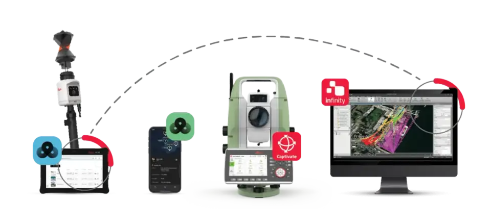
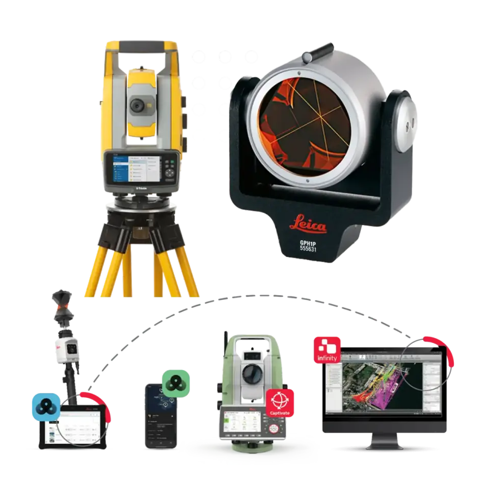
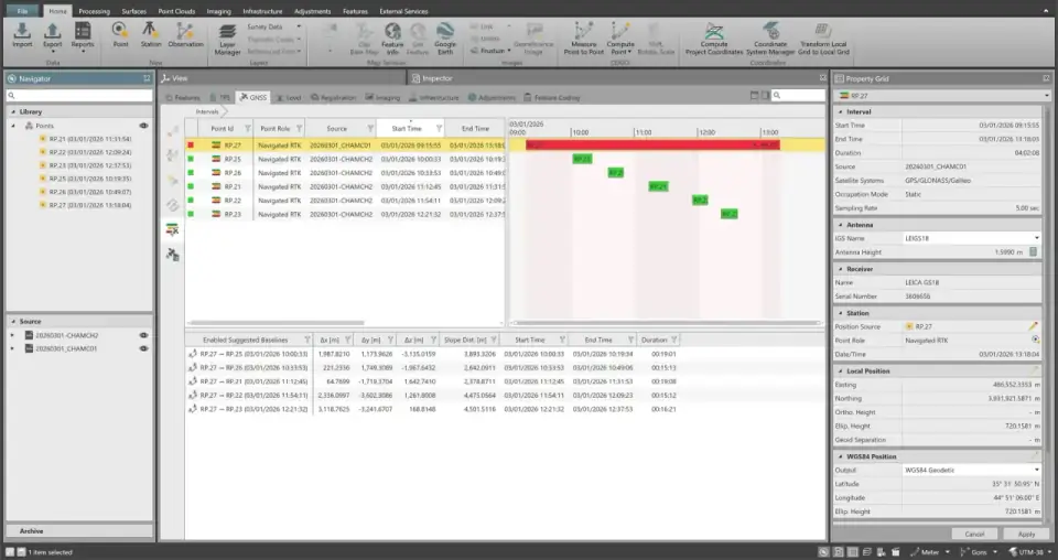
High-Precision Construction Surveying

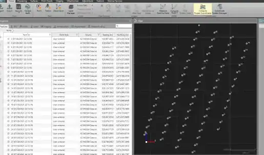
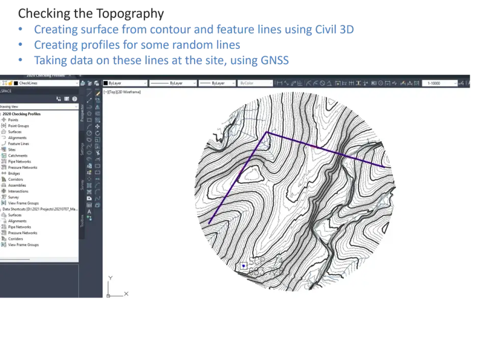
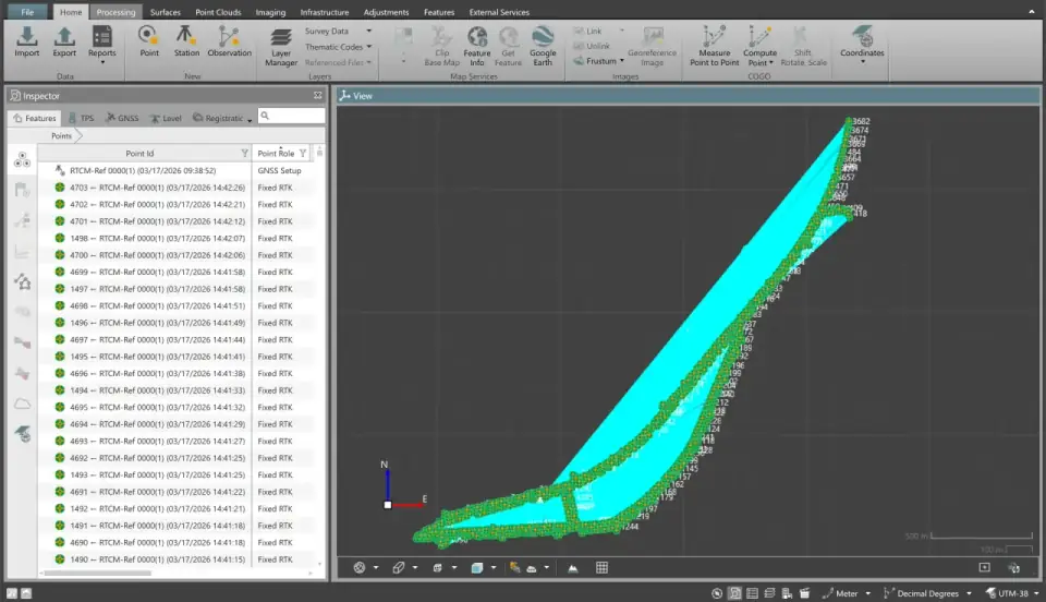
Setting out positions, establishing control points, and verifying as-built conditions with strict compliance to design tolerances. From foundation layout to final handover, every measurement is referenced to a robust geodetic framework.

Setting Out Control Networks As-Built Verification
Aerial mapping with UAV LiDAR

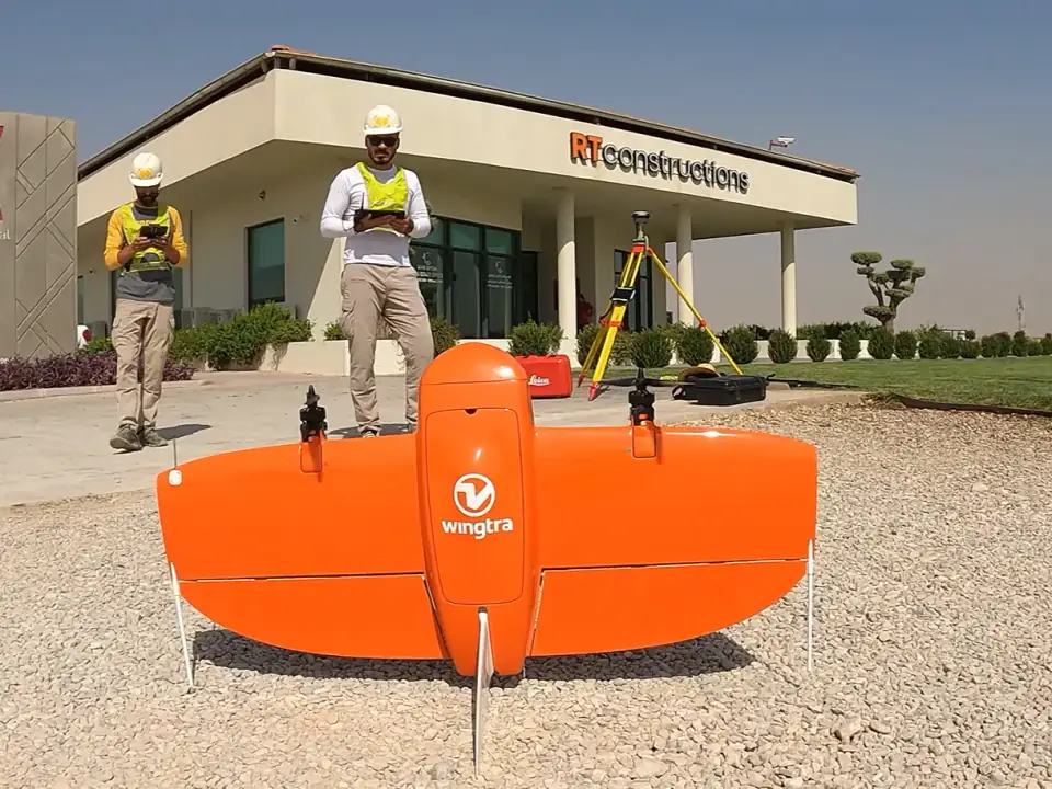
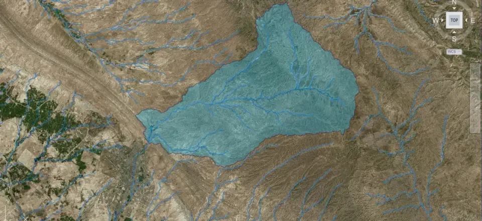
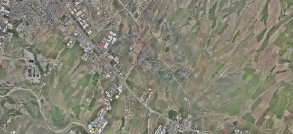
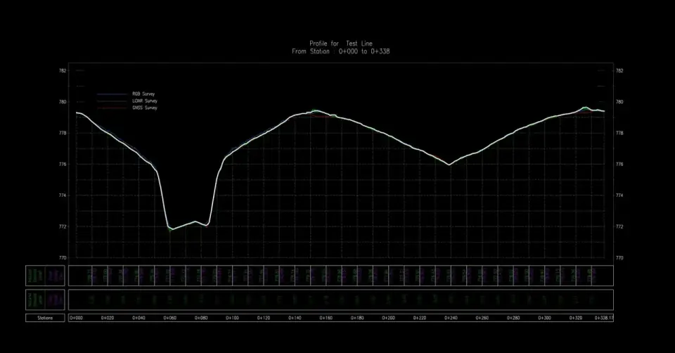
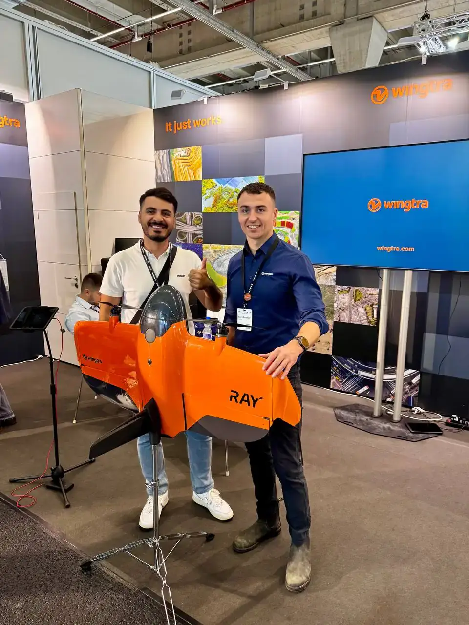
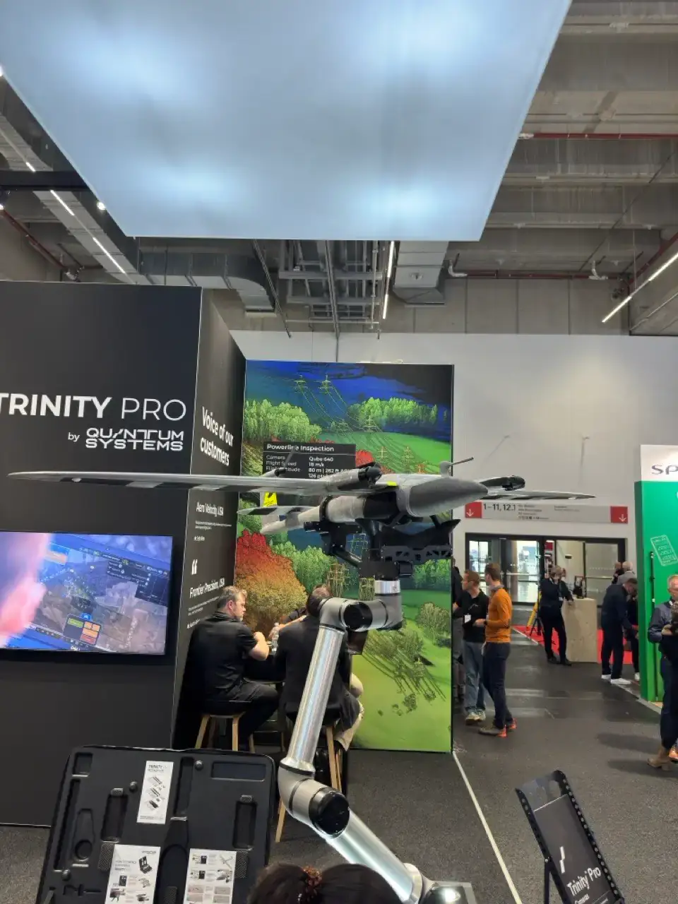
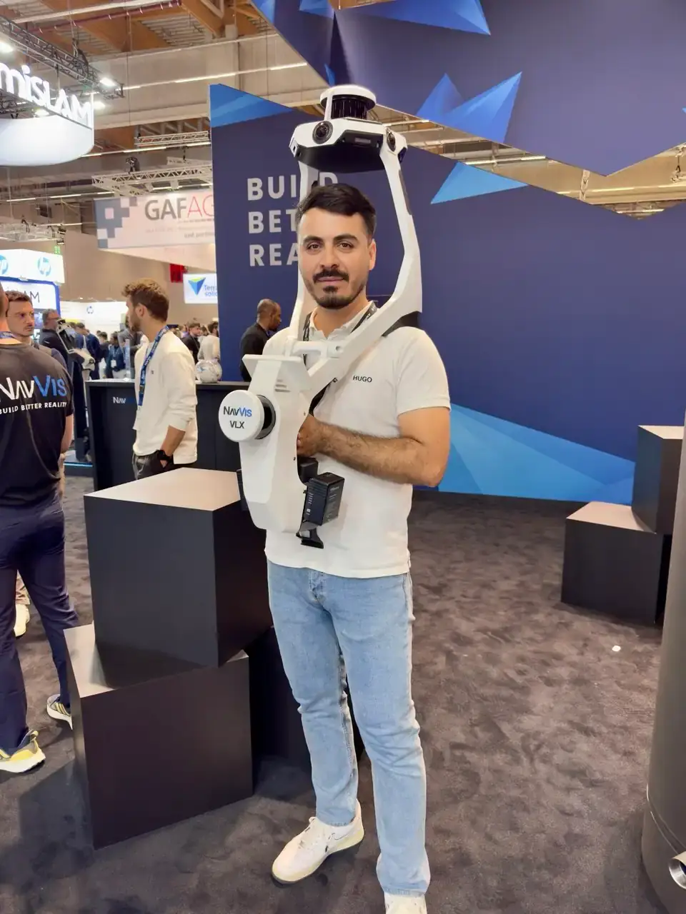
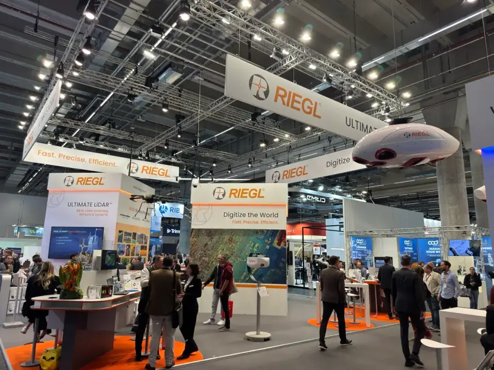
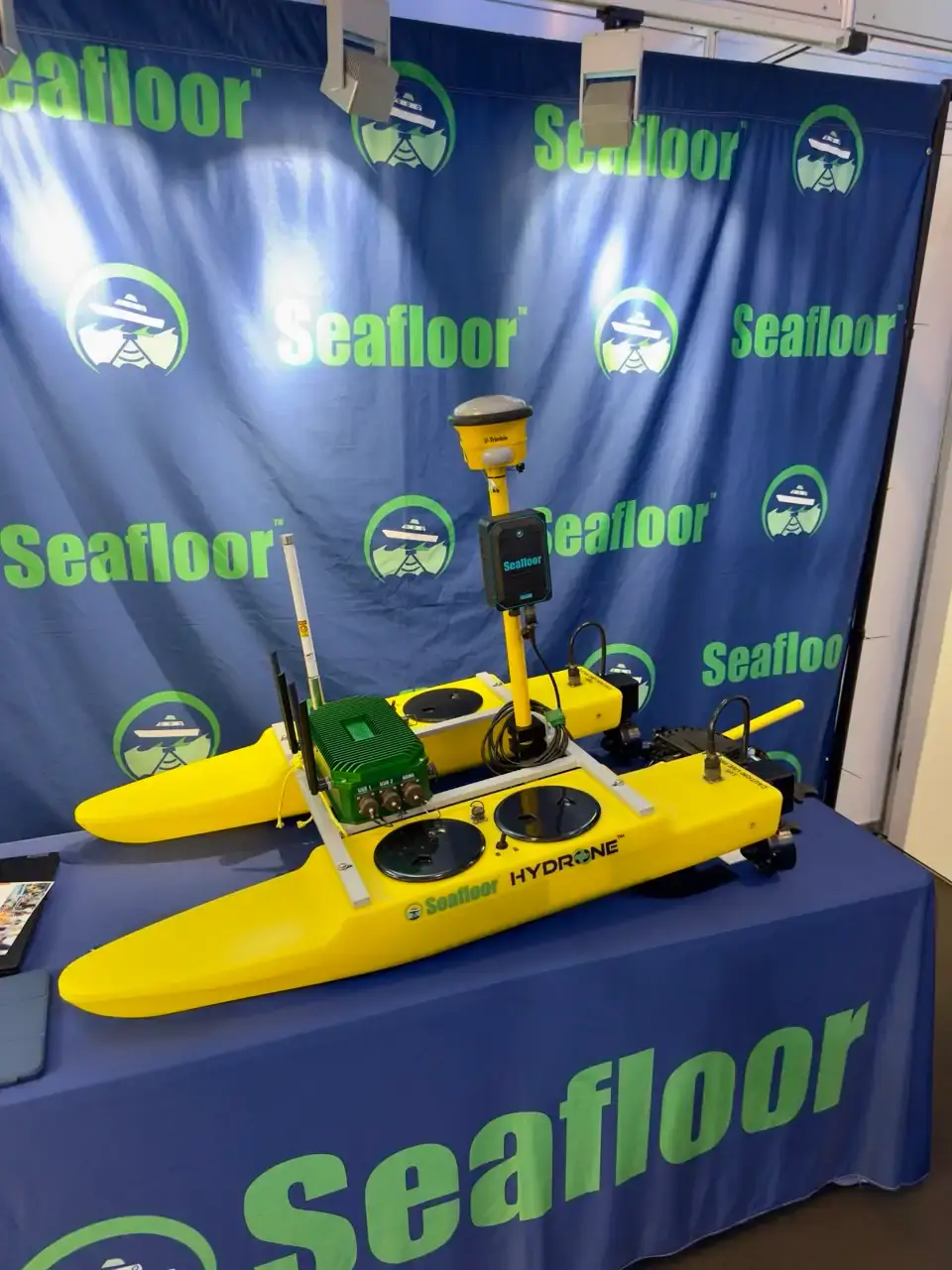
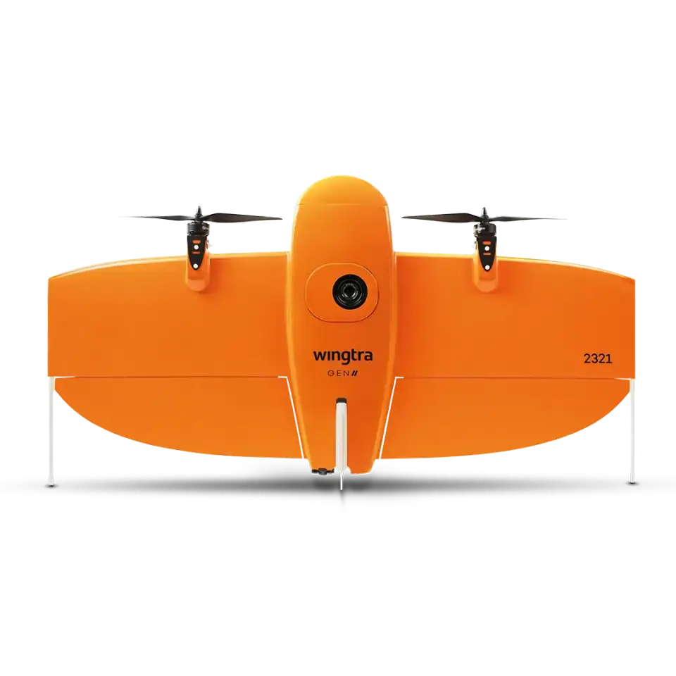
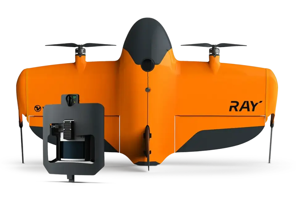
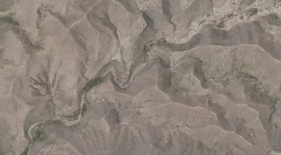
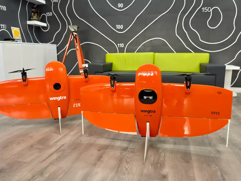
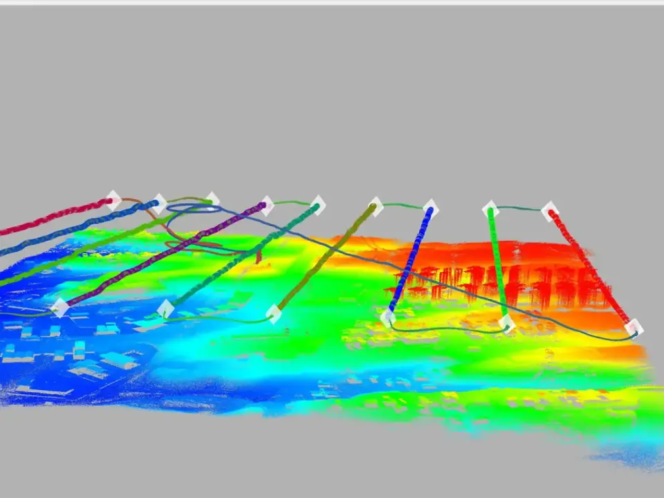
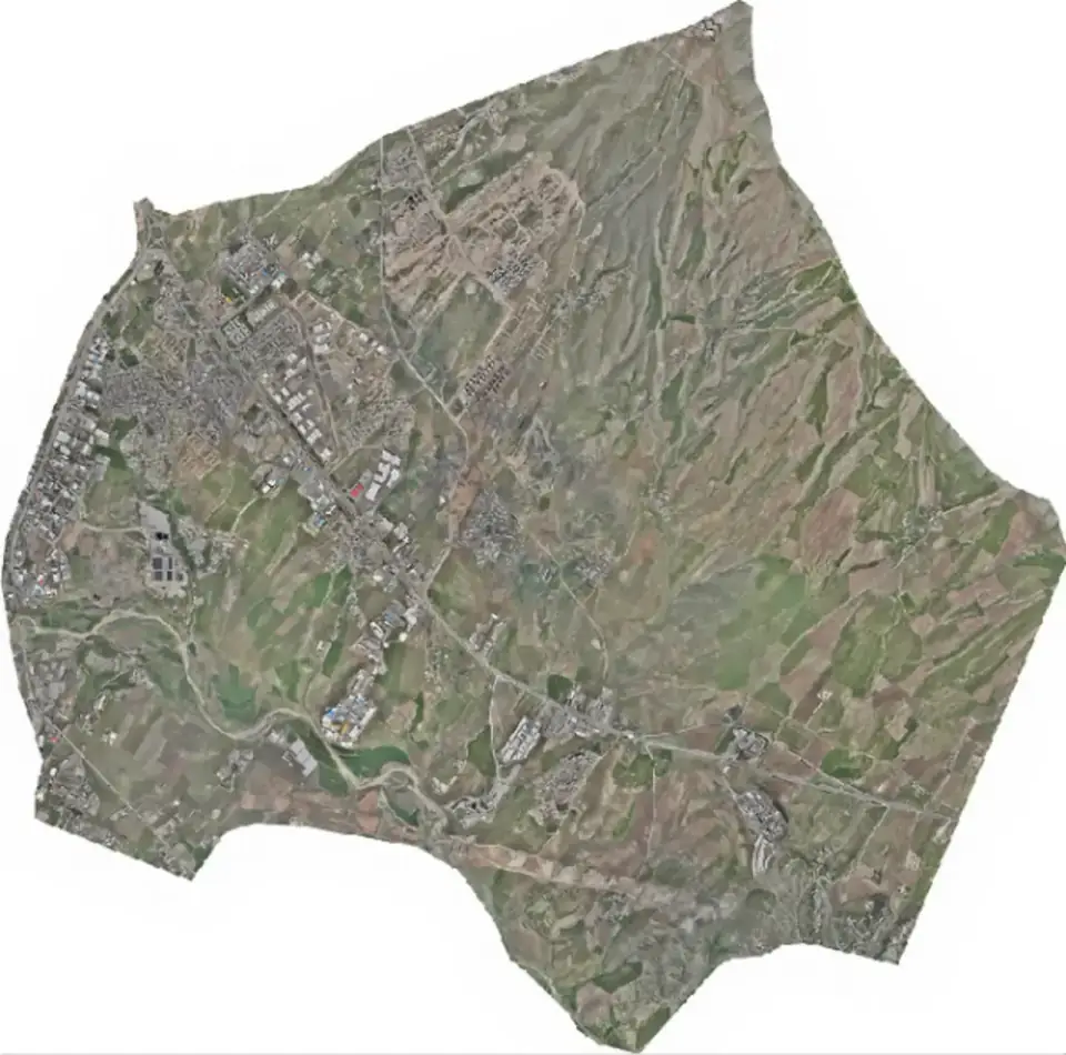
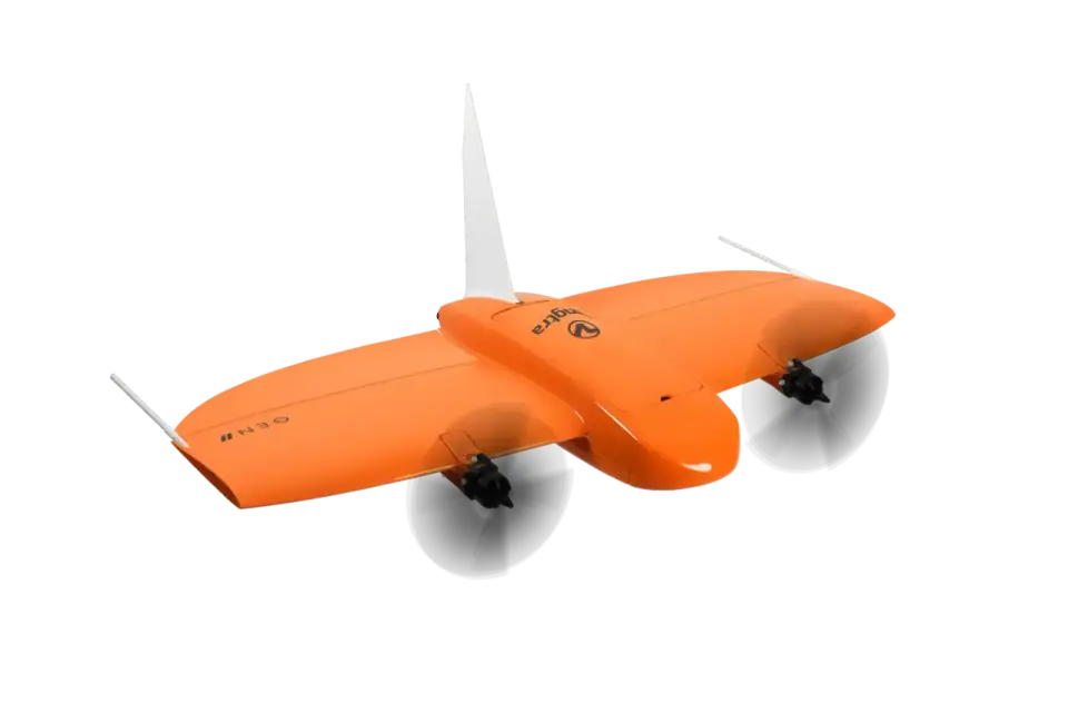
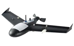
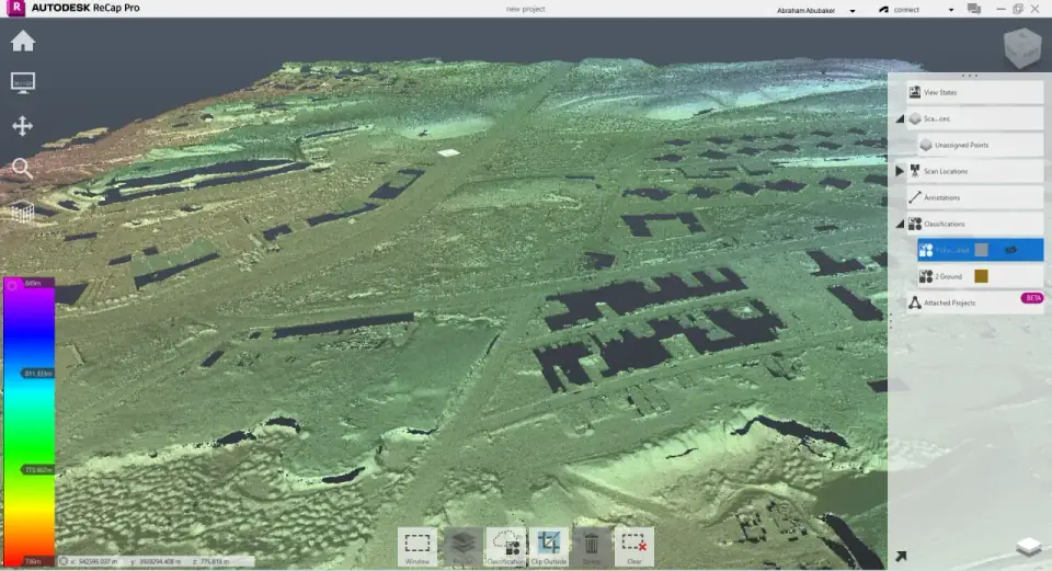
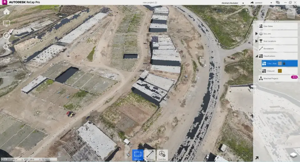
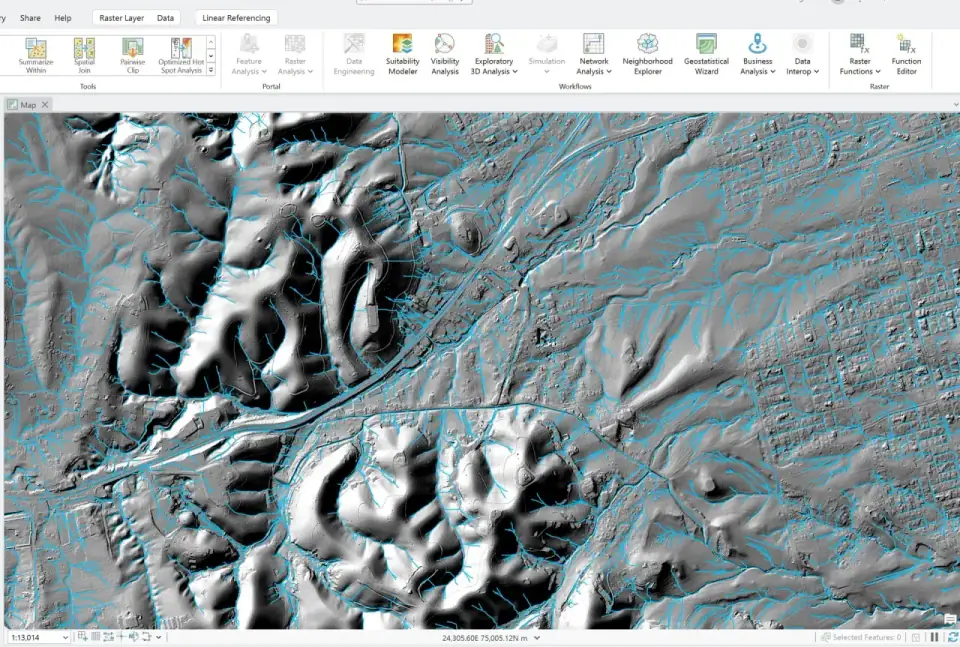
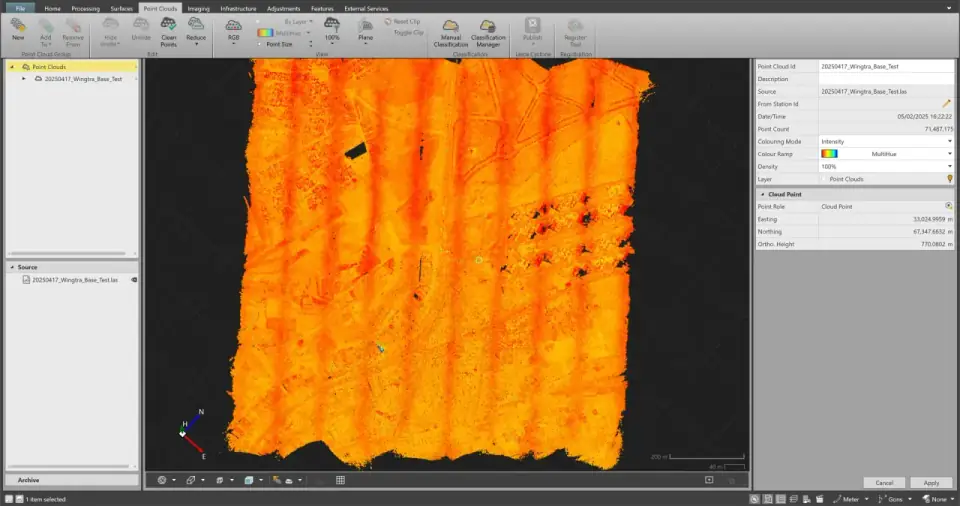
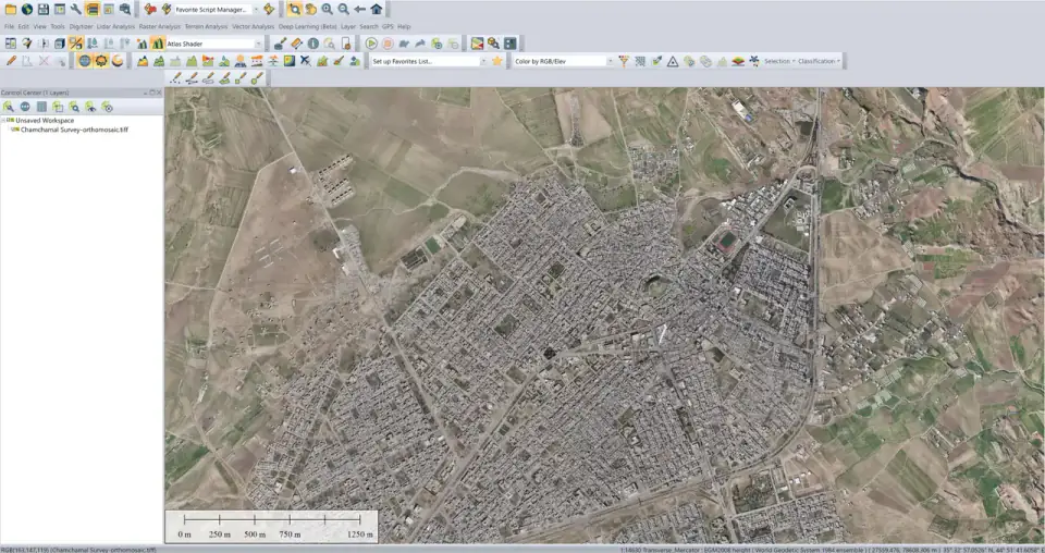
Aerial Mapping & Reality Capture

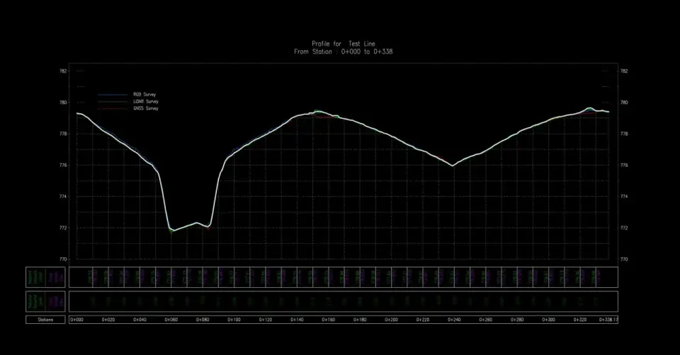
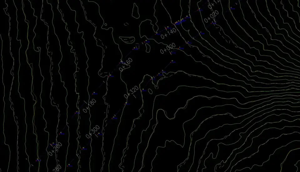
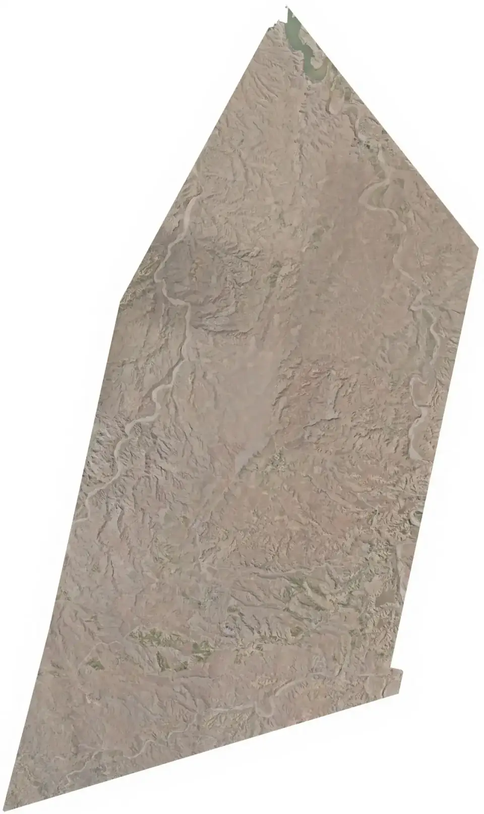
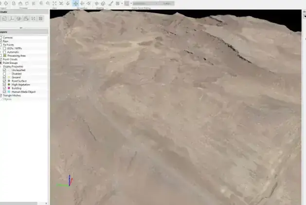
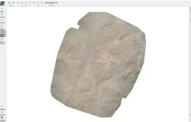
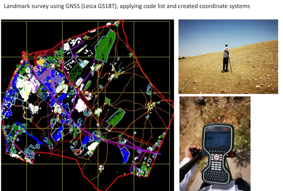
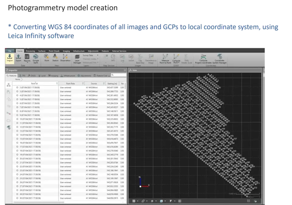
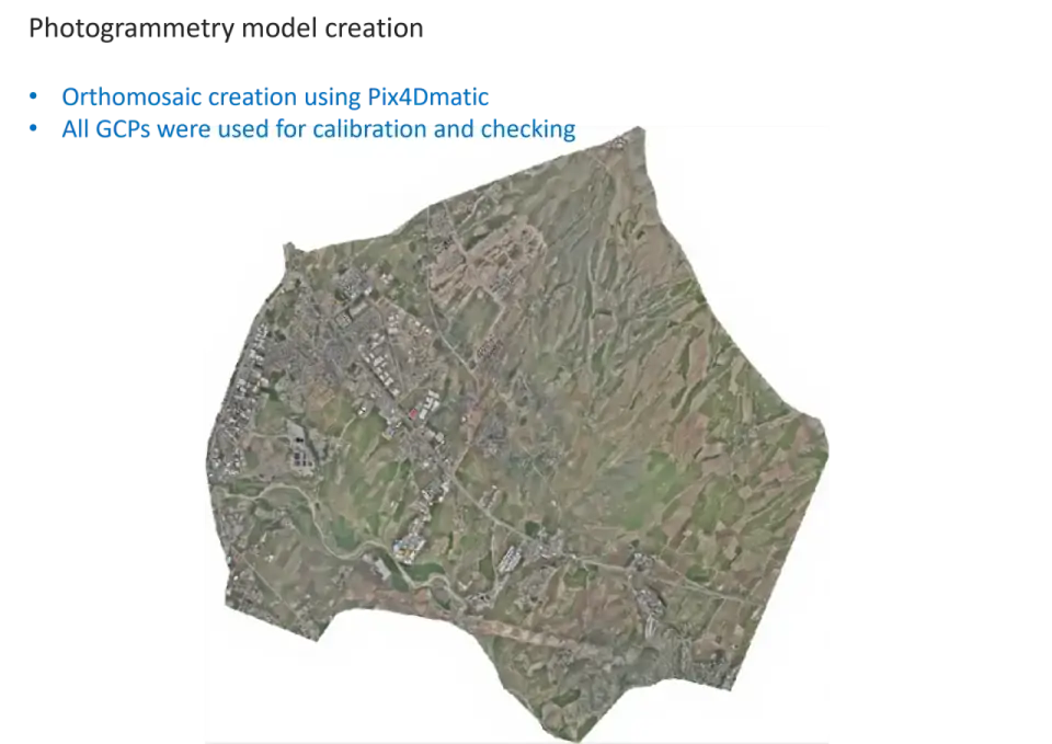
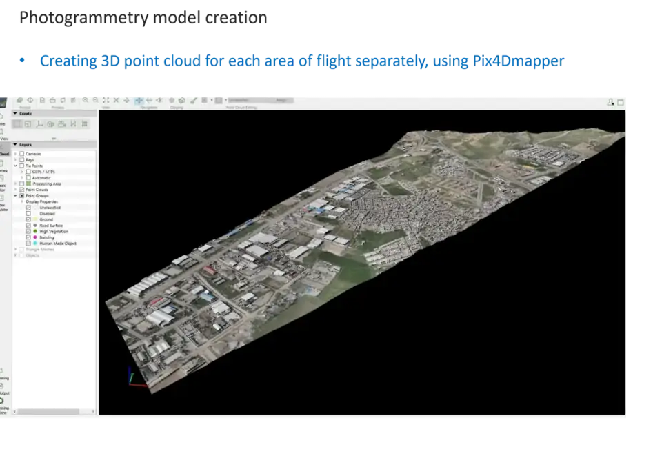
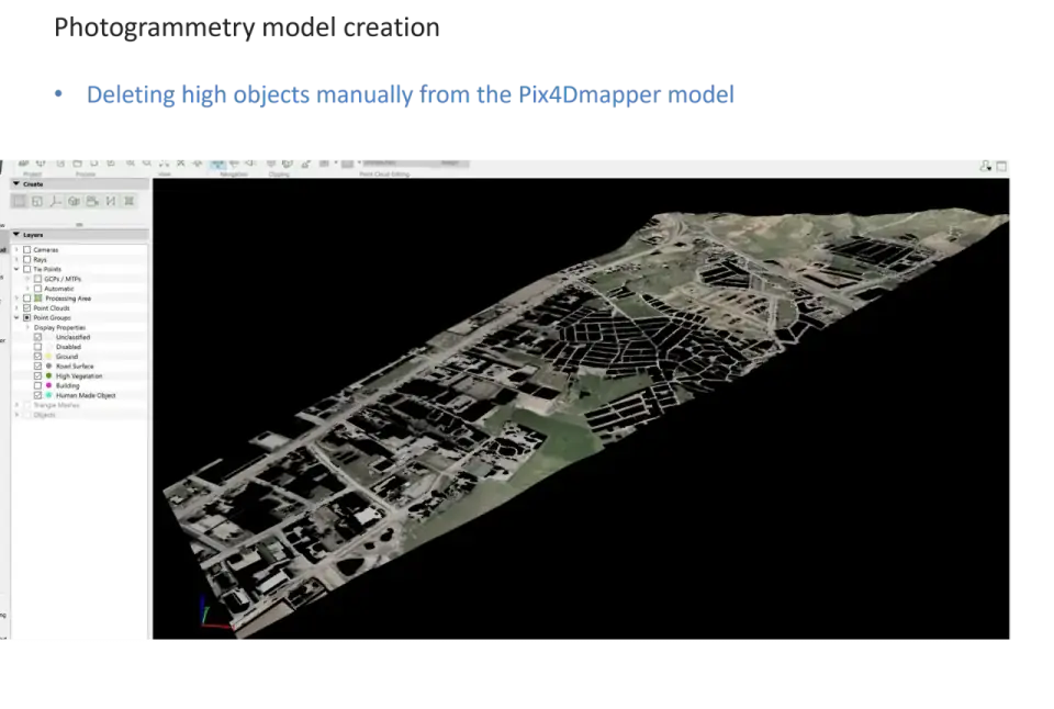
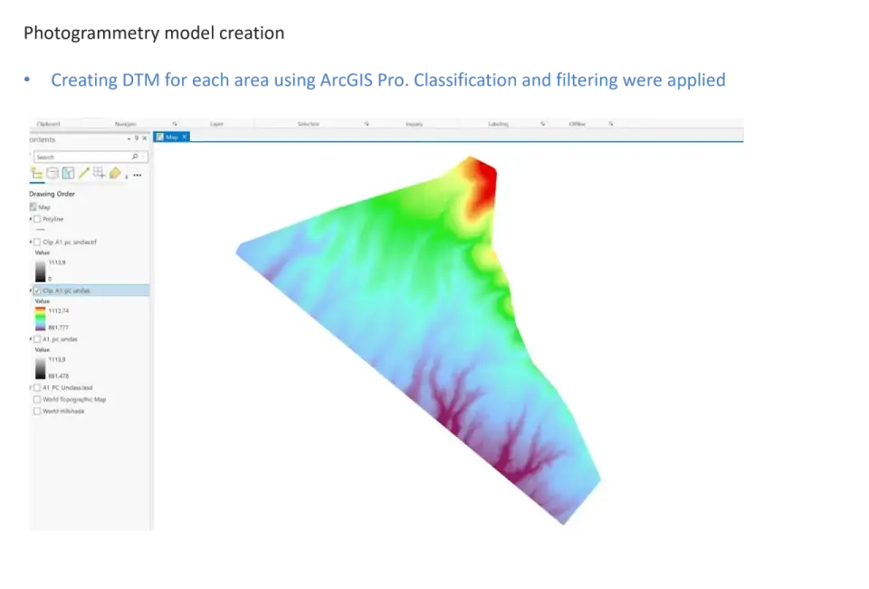
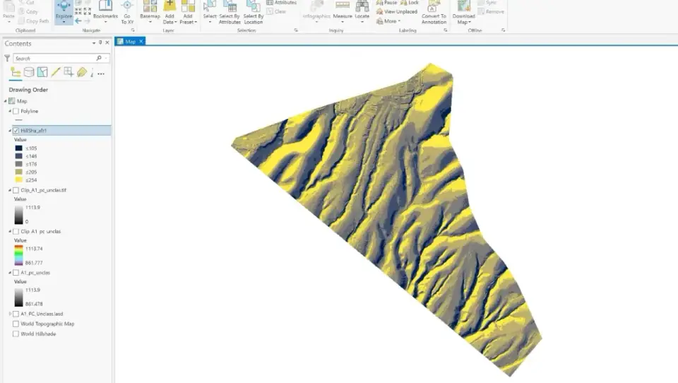
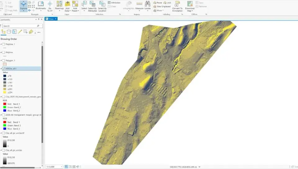
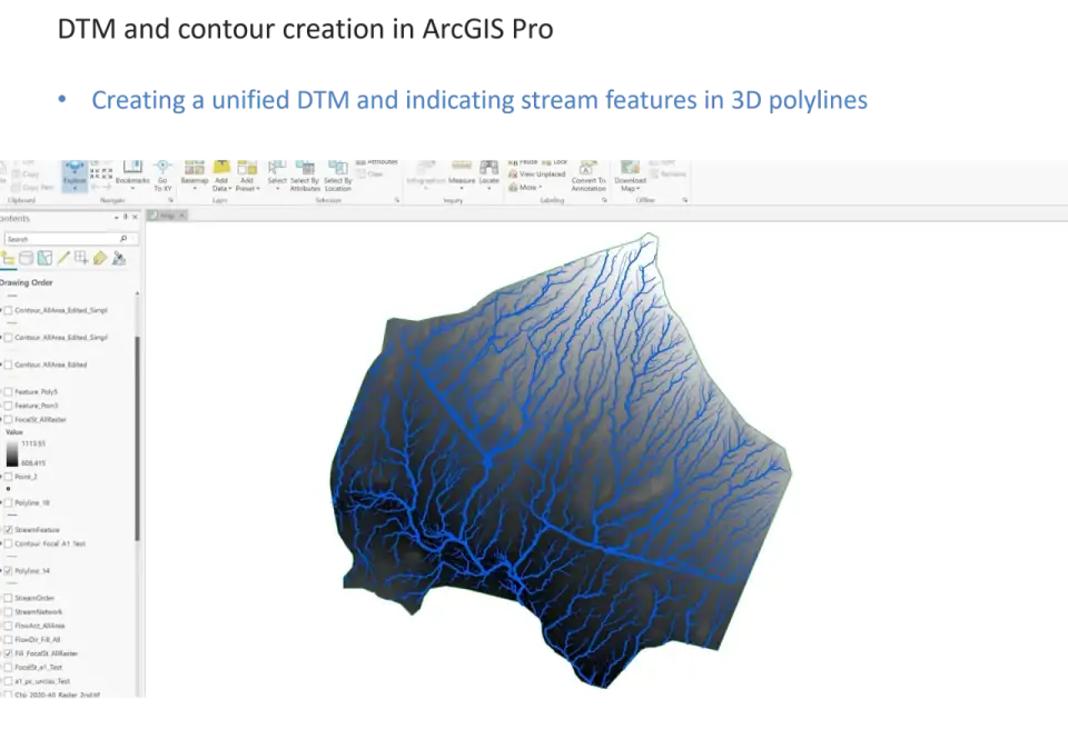
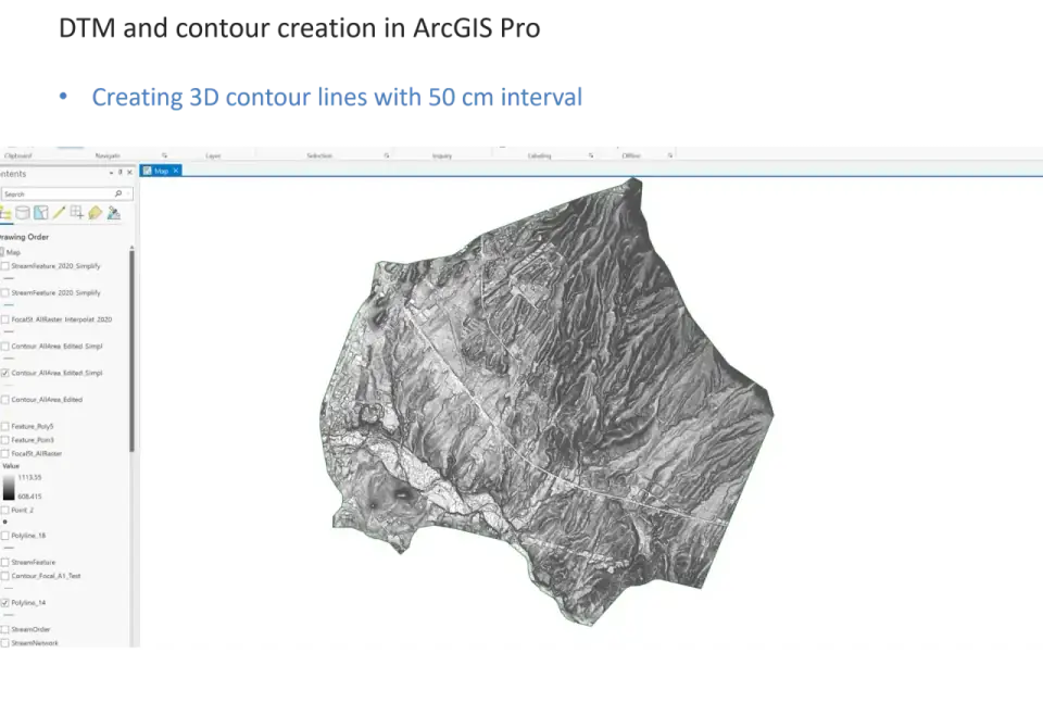
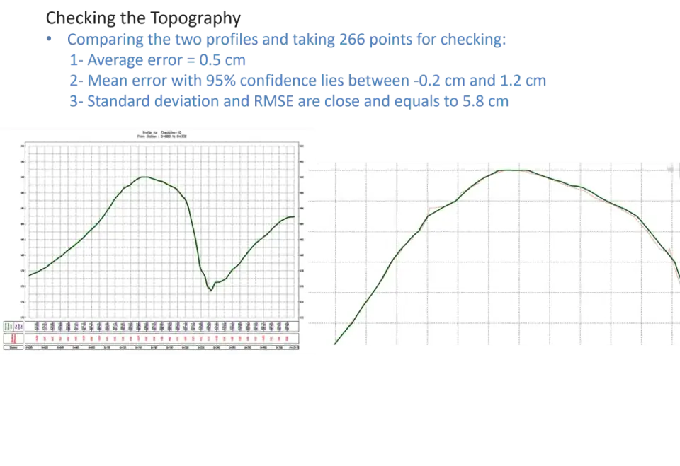
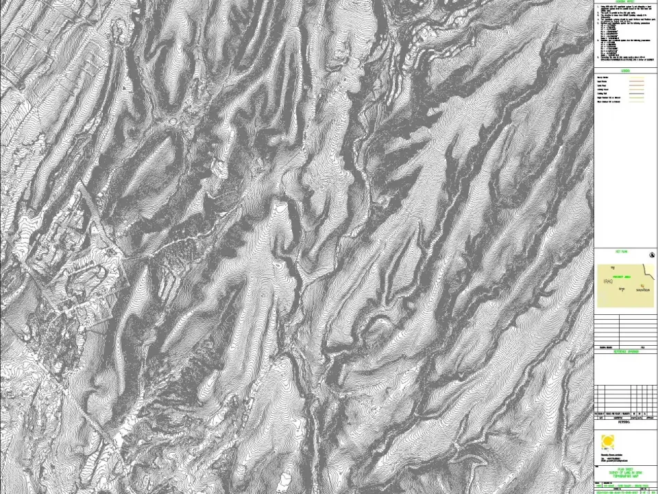
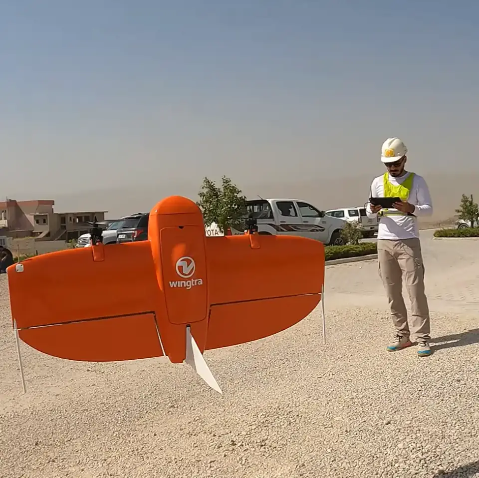
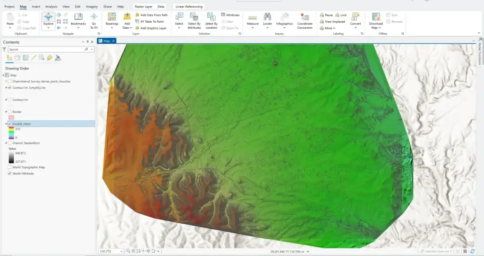
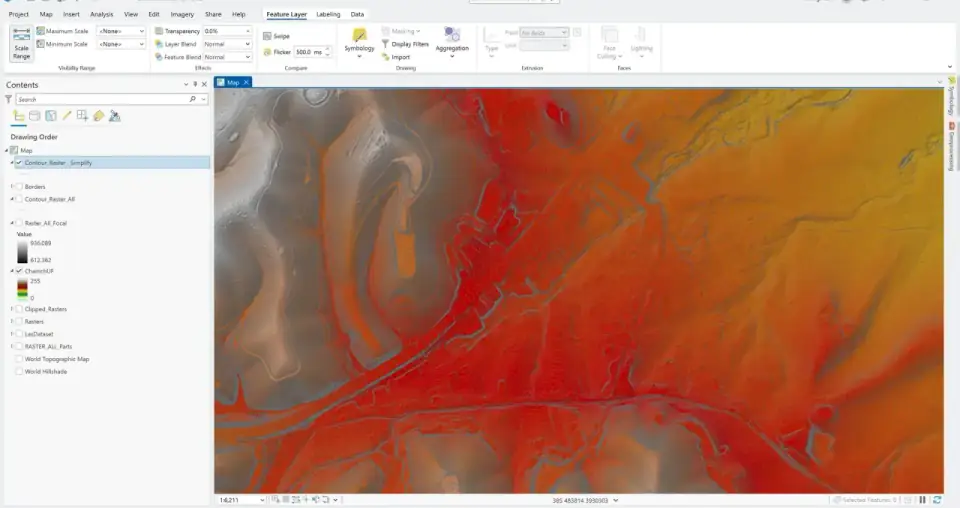
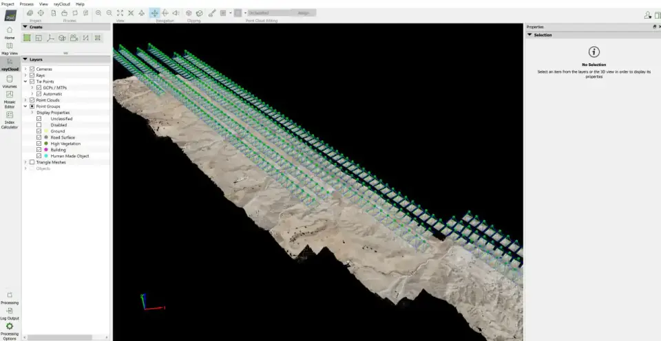
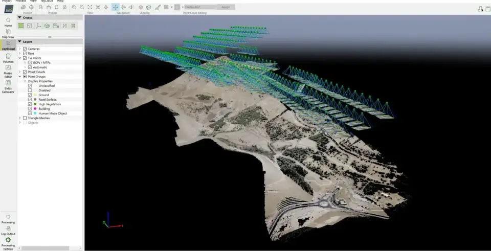
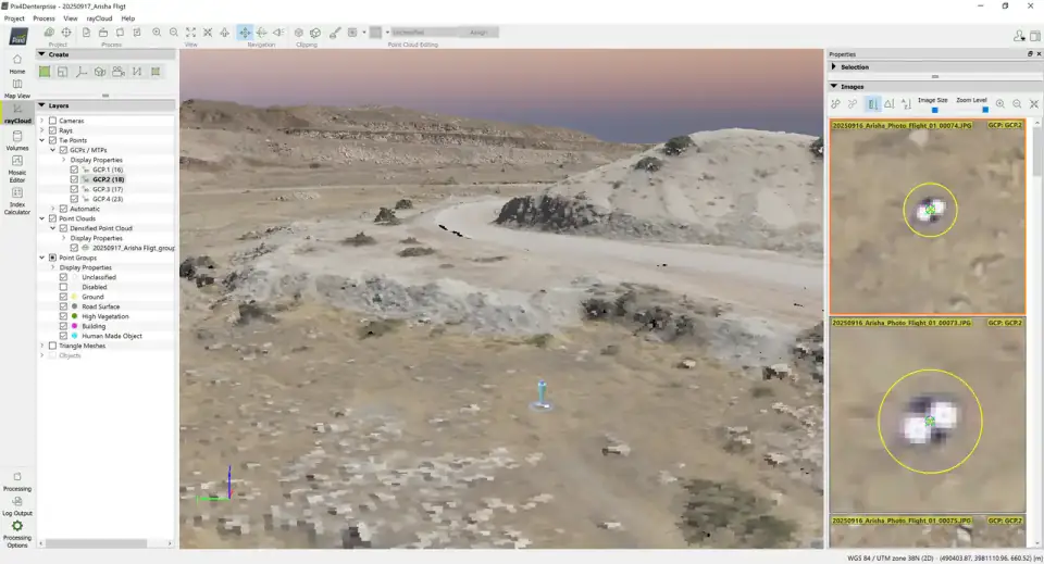
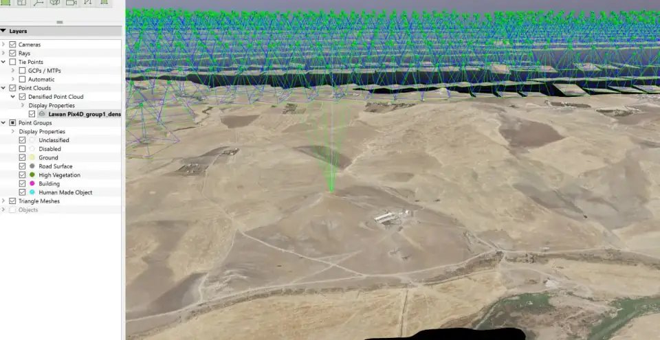
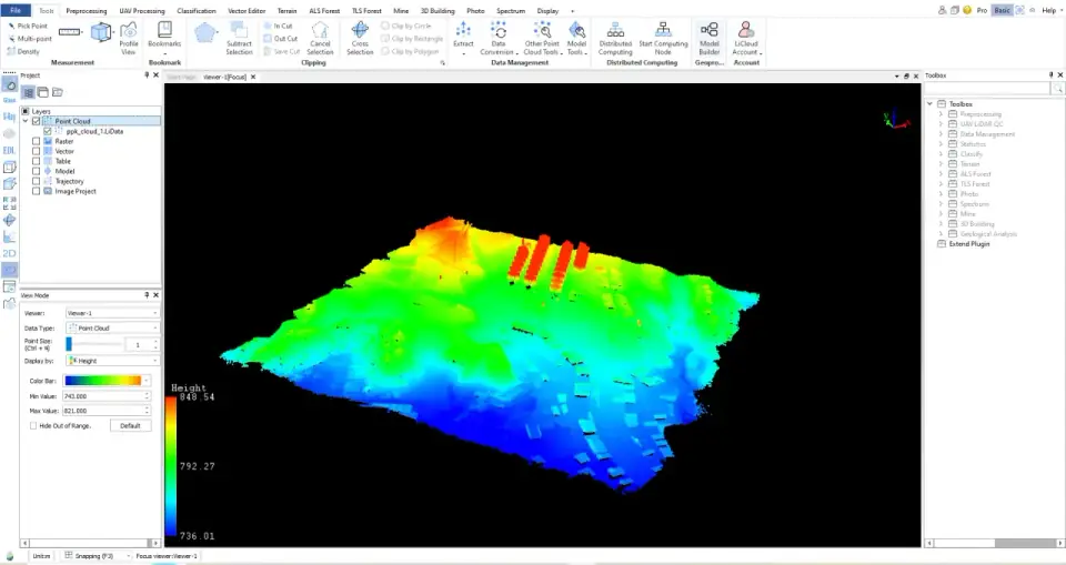
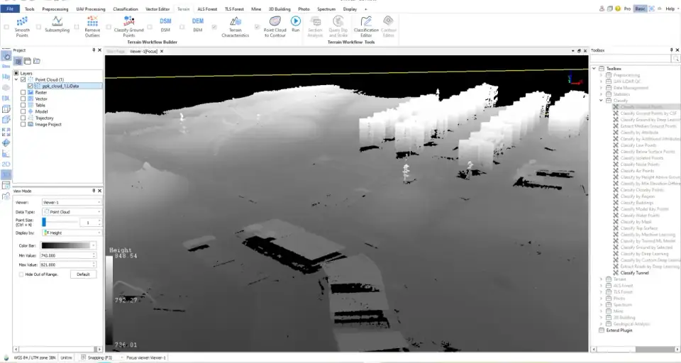
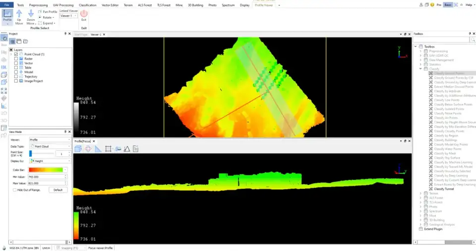
UAV LiDAR-based aerial surveys with GNSS/IMU integration for high-precision terrain models and 3D reconstruction. Deliverables include georeferenced point clouds, orthomosaics, DSM/DTM, and volumetric analysis.

LiDAR Photogrammetry Point Cloud
Earth geoid visualization

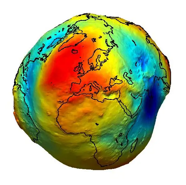
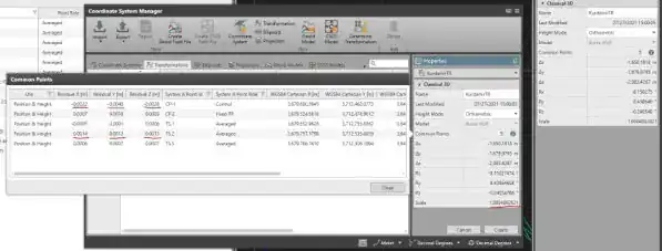
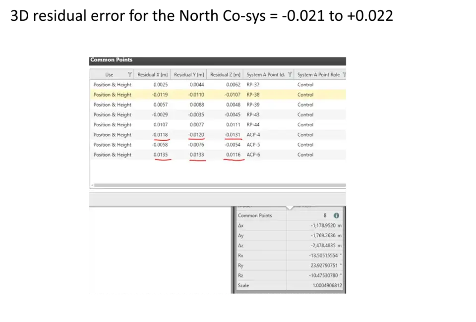
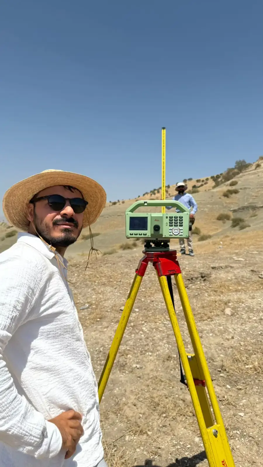
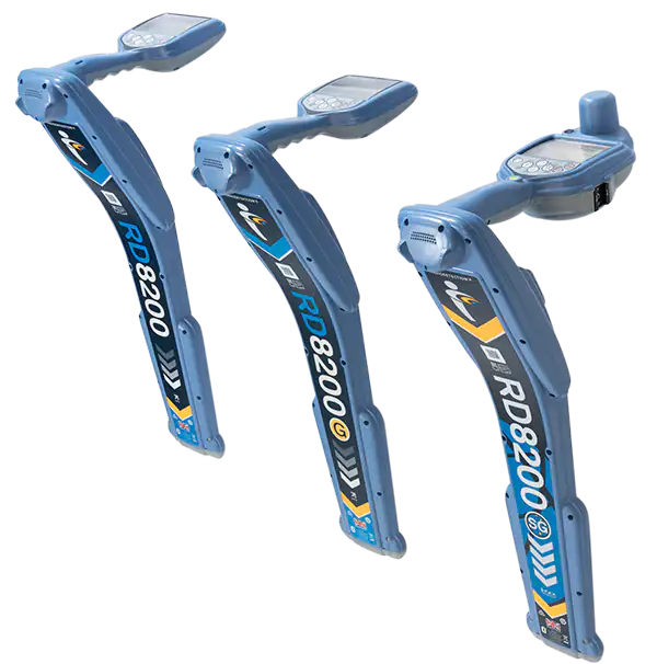
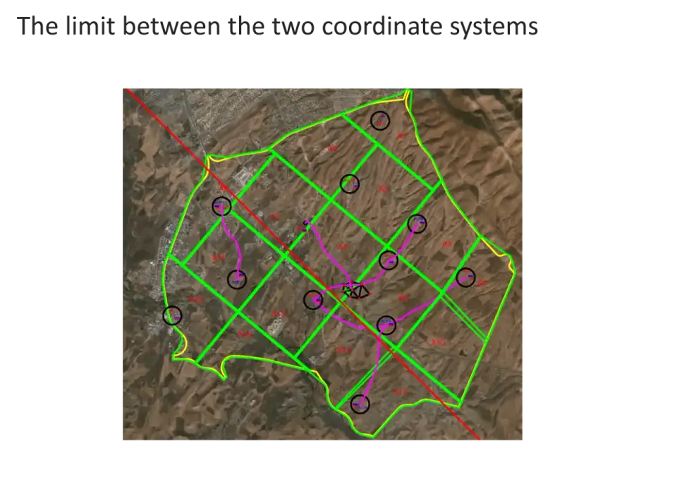
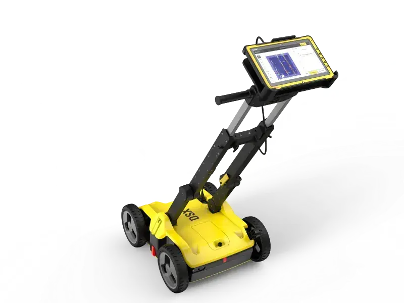
Geodetic & Technical Consulting

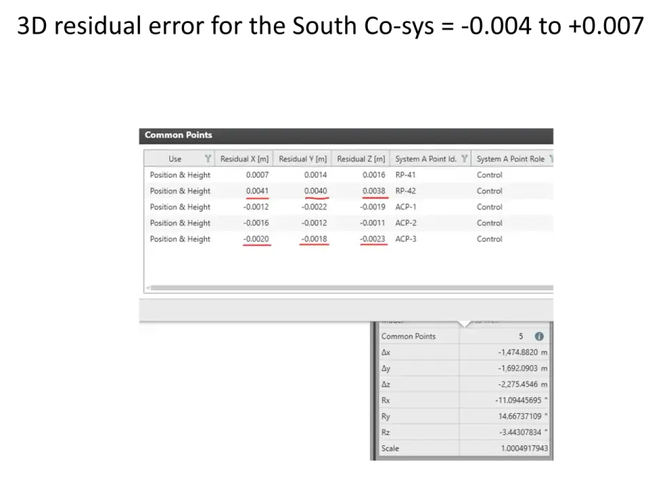
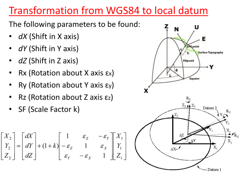
Expert consulting on geodetic datum transformations, coordinate systems, and survey methodology. Guidance on project-specific accuracy requirements, instrument selection, and regulatory compliance for engineering works.

Datum Transformation Coordinate Systems QA/QC

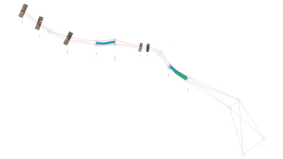
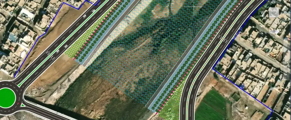
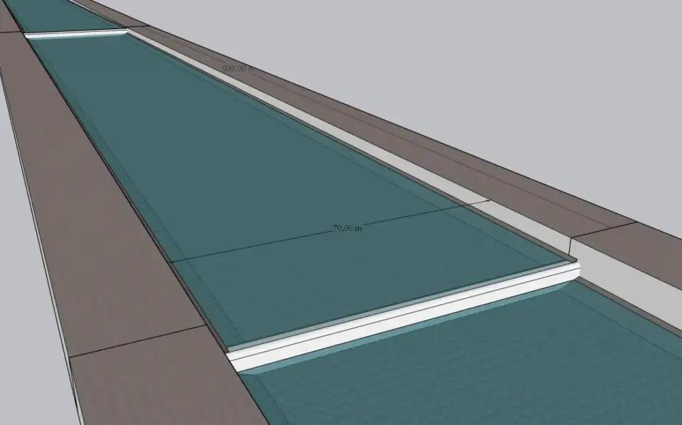
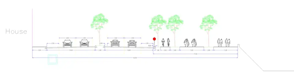
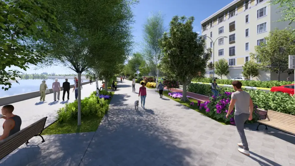
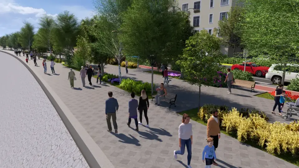
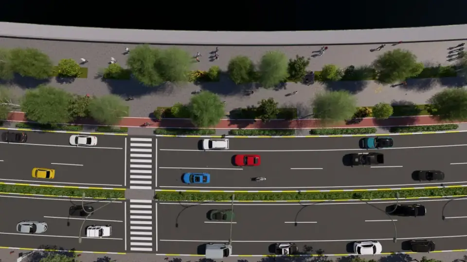
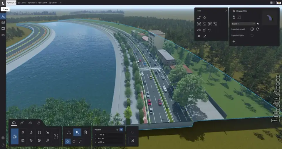
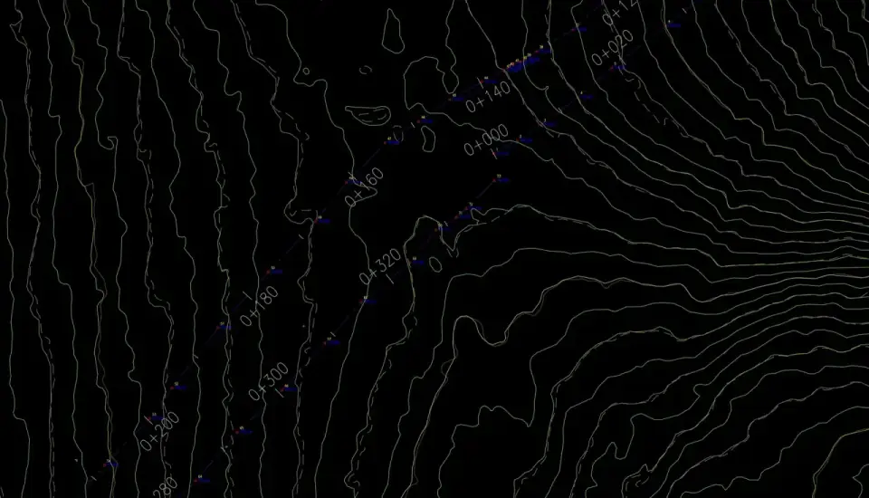
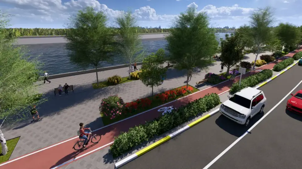
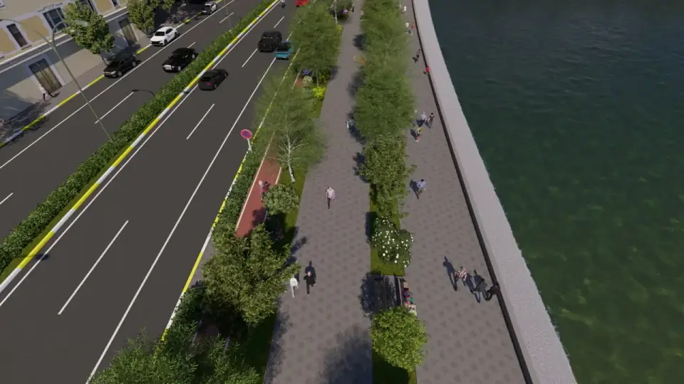
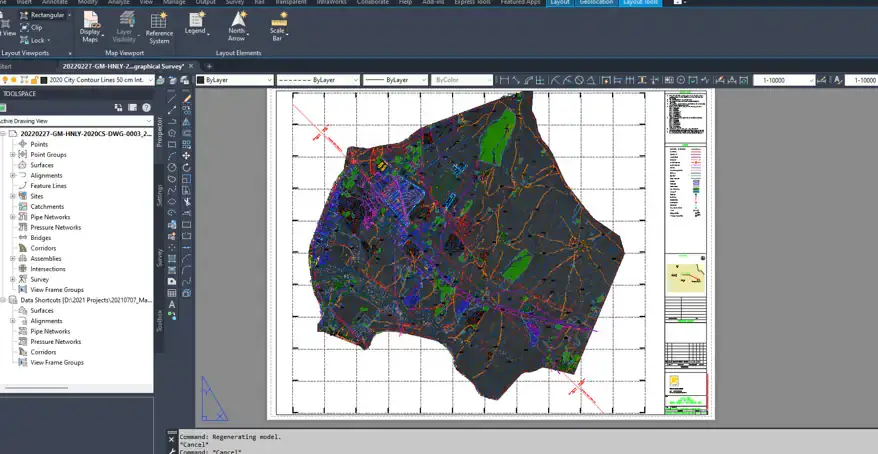
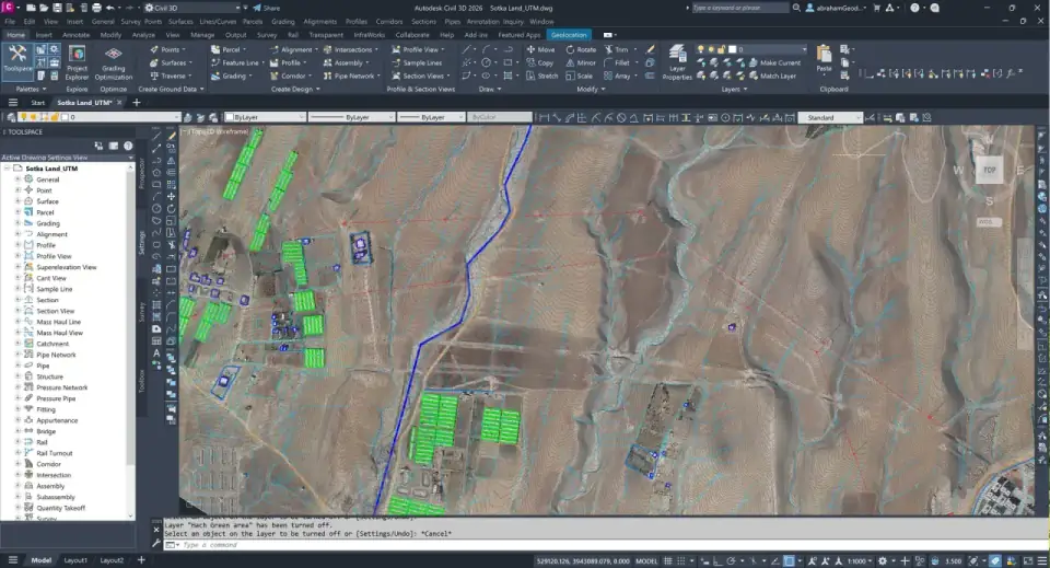
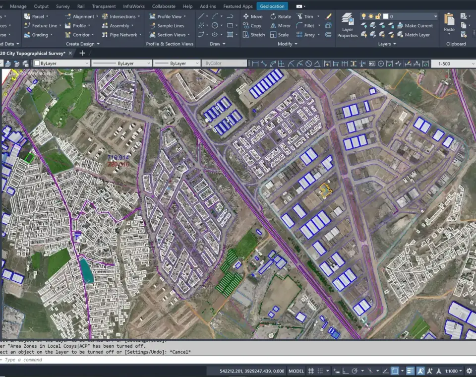
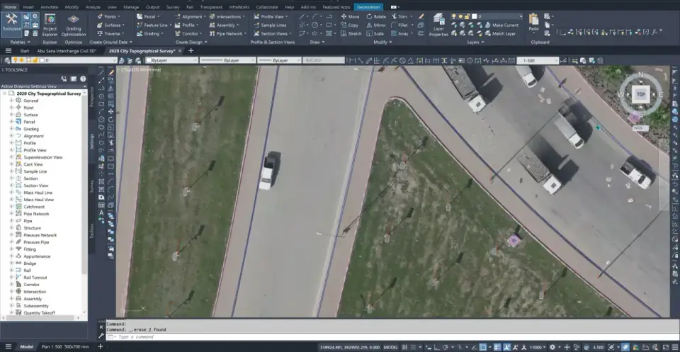
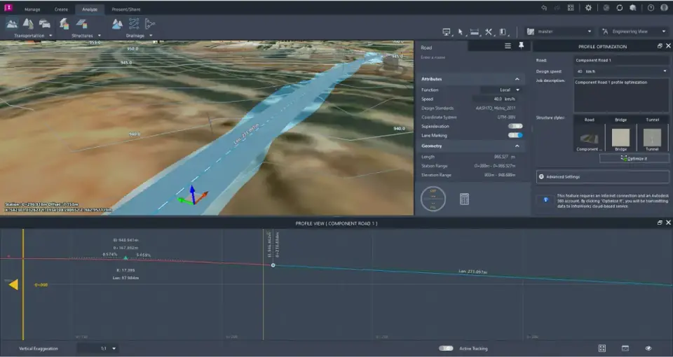
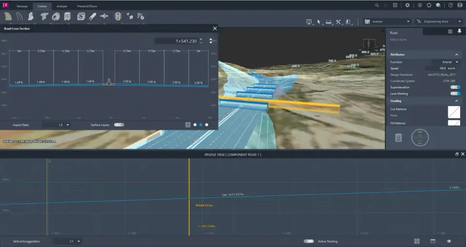
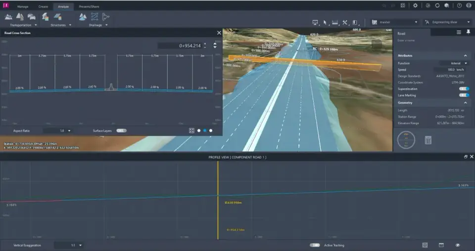
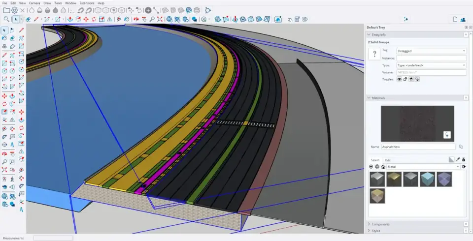
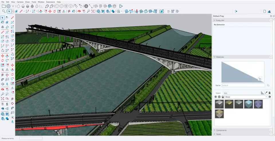
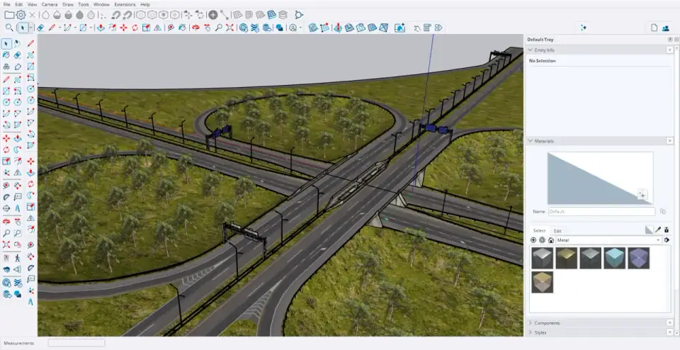
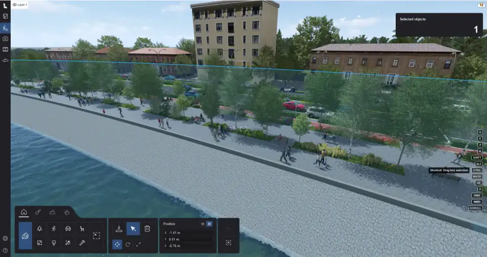
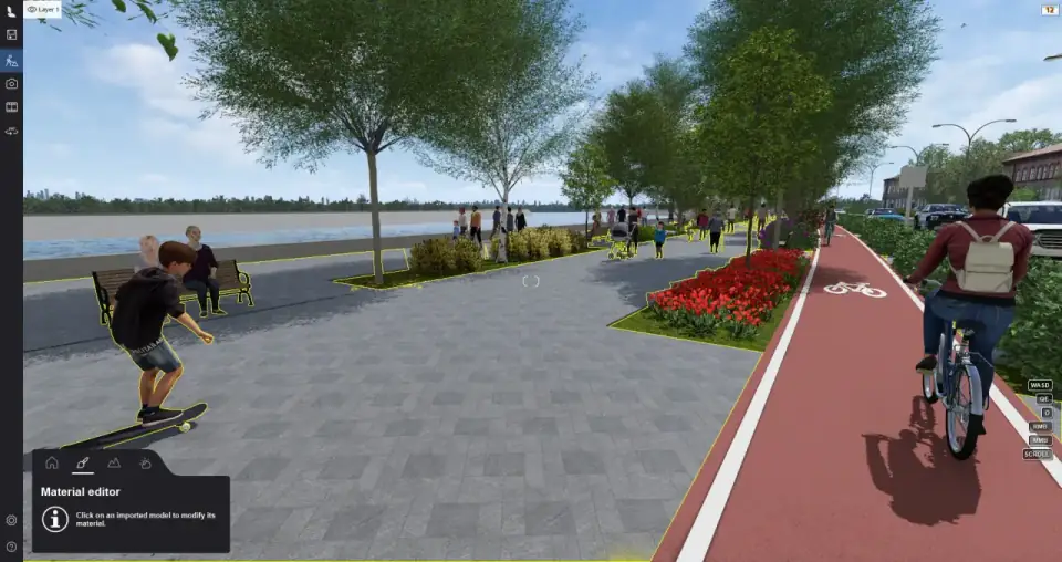
3D Urban Visualization & Roadway Modeling

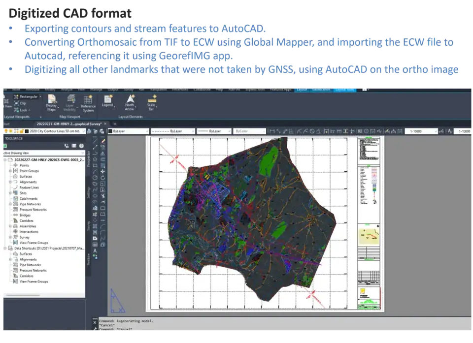
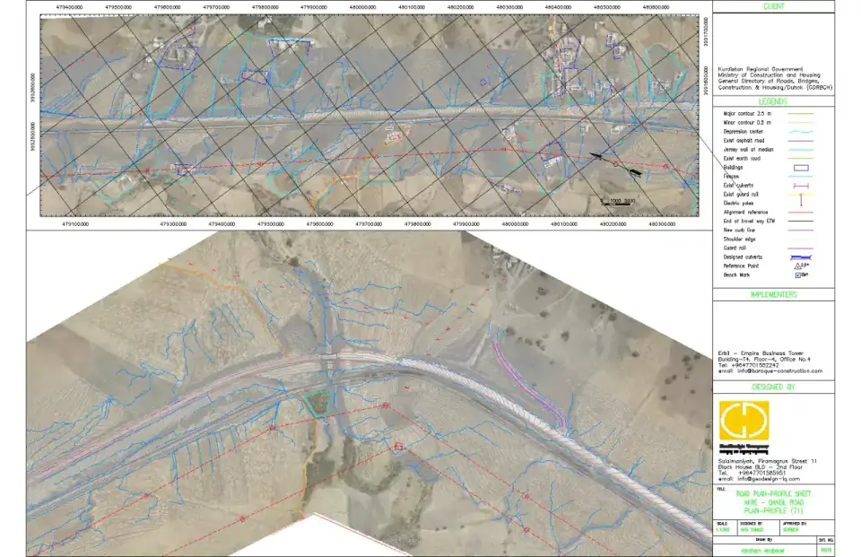
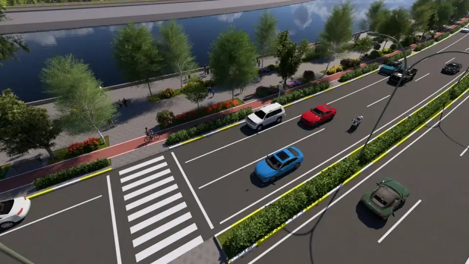
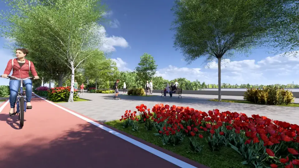
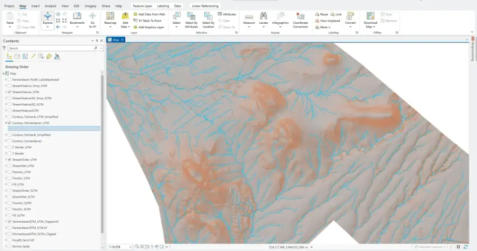
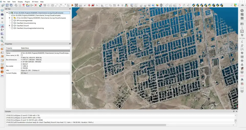
Complex drainage designs, corridor modeling, and urban 3D visualization from survey data. Deliverables include 2D/3D as-built drawings, cross-sections, and infrastructure-ready CAD models for stakeholder presentations and design validation.

Drainage Design 3D Modeling As-Builts
Instruments

Professional-Grade Hardware

Precision starts with the right tools. I operate and manage a range of industry-leading surveying and mapping instruments, ensuring every data point meets the highest accuracy standards.

Surveying Hardware (GNSS & Positioning)

Leica GS18 T
GNSS RECEIVER
Multi-frequency RTK receiver with tilt compensation
Leica TS16
TOTAL STATION
Robotic total station with ATRplus technology
Leica LS15
DIGITAL LEVEL
High-precision digital leveling system

Aerial Mapping & UAV Platforms

WingtraOne GEN II
High-Resolution Photogrammetry
Sensor: 42MPFull-Frame RGB Camera
DJI Phantom 4 RTK
Aerial LiDAR (Active Sensor)
Sensor: Multi-return Laser Scanner.

Subsurface Utility Engineering

Subsurface utility detection
GPR & CABLE LOCATOR
Subsurface utility detection, mapping & tracing for buried infrastructure
Portfolio

Featured Projects

End-to-end project case studies showcasing the full scope of surveying, mapping, and engineering design — from geodetic control establishment to final 3D visualization deliverables.

Slemani geodetic control network
Geodesy DTM

Slemani 6,000-Hectare Survey

60 km² topographic mapping in 65 days. Custom 7-parameter Bursa-Wolf transformation, VTOL photogrammetry, and QA against 266 independent checkpoints achieving 0.5 cm average error.

View Project
Kurdameer aerial orthomosaic and terrain analysis
Aerial Survey Energy Sector Featured by PIX4D

Kurdameer 10,500-Hectare Mapping

105 km² aerial mapping for WesternZagros energy infrastructure. 18,000+ images processed to DTM with hydrological analysis for pipeline corridors and well-pad planning.

View Project
Tasluja to Kaniwatman expressway corridor survey
Highway Infrastructure Rapid Deployment

Tasluja-Kaniwatman Expressway

80 km+ A6 flexible pavement corridor. Delivered the first 36 km survey package in 28 working days using Leica LS15 leveling and dual-drone LiDAR/photogrammetry fusion in Civil 3D.

View Project
Khasa River Restoration 3D visualization
Hydraulic Engineering Digital Twin

The Khasa River Restoration

A 21.5 km sustainable urban corniche transforming a dry riverbed into a cascading green corridor with 43 engineered ponds, MBR water treatment, and photorealistic 3D visualization.

View Project
LiDAR vs Photogrammetry vertical accuracy profile comparison
R&D Sensor Benchmarking

LiDAR vs. Photogrammetry Benchmarking

Empirical analysis of vertical accuracy across crops, dense foliage, and asphalt using simultaneous dual-WingtraOne GEN II deployment with RTK/PPK ground truth validation.

View Project
INTERGEO 2025 Frankfurt geospatial expo
Industry Innovation Frankfurt 2025

INTERGEO 2025 Highlights

Engagement with the global geospatial community in Frankfurt — evaluating next-generation Leica Geosystems, Wingtra VTOL, and Reality Capture technologies that feed directly into my daily workflows.

View Project
Software

Software & Processing Stack

From raw data acquisition to final deliverable, I leverage a comprehensive software ecosystem spanning CAD design, geospatial analysis, LiDAR processing, and 3D visualization.

Civil 3D
Autodesk Civil 3D
Design & Drafting
ReCap Pro
Autodesk ReCap Pro
Point Cloud Processing
InfraWorks
Autodesk InfraWorks
Infrastructure Modeling
ArcGIS Pro
ArcGIS Pro
Geospatial Analysis
Pix4DMapper
Pix4DMapper
Photogrammetry
LiDAR360
LiDAR360
LiDAR Processing
LiDAR360
CloudCompare
Point Cloud Classification
Leica Infinity
Leica Infinity
Survey Data Processing
Global Mapper
Global Mapper
GIS & Terrain Analysis
SketchUp Pro
SketchUp Pro
3D Modeling
Lumion
Lumion
3D Visualization
Microsoft Office
Microsoft Office
Documentation & Reports
Skills

Core Competencies

Technical Skills

UAV LiDAR Operations & ProcessingExpert
GNSS/IMU IntegrationExpert
Construction SurveyingExpert
Point Cloud Classification & AnalysisAdvanced
3D Terrain & Corridor ModelingAdvanced
Geospatial QA/QC & Accuracy AssessmentAdvanced
Drainage Design & Civil EngineeringAdvanced

Languages

Kurdish
Native
English
C1 — Advanced
Arabic
Advanced
German
A2 — Growing

Certifications & Education

Certified WingtraOne Operator
VTOL UAV operations for precision aerial mapping
BSc Petroleum Engineering
University of Kirkuk — Recognized equivalent to German BSc
About

Who I Am

I am a Geospatial & LiDAR Systems Engineer and Civil Surveying Specialist with over six years of experience in Aerial Mapping, Construction Surveying, and Infrastructure Development. My experience is backed by an engineering qualification from the University of Kirkuk, where I completed my BSc in Petroleum Engineering, which is recognized at an equivalent level to a German BSc degree.

My profession is characterized by the integration of advanced technology with site-based precision. I have extensive practical experience working with advanced technology using UAV LiDAR systems to process GNSS/IMU integration for high-precision terrain models and 3D reconstruction products. In addition to aerial survey mapping, I have extensive experience working with construction surveying services, including setting out positions, establishing control points, and checking as-built conditions to ensure strict compliance with tolerances.

I am a certified WingtraOne operator, focused on providing high accuracy deliverables such as LAS/LAZ point cloud, TIFF, complex drainage designs, and 2D/3D as-builts. My approach is characterized by technical flexibility, utilizing tools such as Autodesk Civil 3D, ArcGIS Pro, and LiDAR360, as well as attention to geospatial accuracy and QA/QC.

In addition to my technical work, I am a multilingual professional, fluent in Kurdish (native), English (C1), and Arabic (advanced), with a growing proficiency in German (A2).

Abraham Abubaker
Geospatial & LiDAR Systems Engineer
6+ Years Experience
BSc Petroleum Engineering
Certified WingtraOne Operator
Kurdish, English, Arabic, German
LiDAR UAV GNSS Civil 3D ArcGIS QA/QC
Contact

Let's Build Something Precise

Whether you need aerial mapping, construction surveying, or geospatial consulting, I'm ready to deliver centimeter-level accuracy for your next project.